

Collection: Osher Map Library Collection
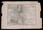
Name: Map of Colorado Territory, United States
Barcode:
Image Number:
Creator:
Publishing Location:
Date/Date Range Produced:
Date/Date Range Published:
Language:
Dimensions: 28 x 21
Physical Description: Shows counties, towns, forts, roads, Indian reservations and natural features.
LC Call Number: G4310 1867.I4
OCLC: 7151627
Accession Number: OML-1867-45
Permanent URL: