

Collection: Textile Museum Collection
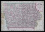
Name: Colton's sectional map of the state of Iowa compiled from the U.S. surveys & other authentic sources exhibiting the sections, fractional sections, counties, cities, towns, villages, post offices, railroads & other internal improvements
Barcode:
Image Number:
Publisher:
Publishing Location:
Date/Date Range Published: 1870
Language:
Dimensions: 62 x 91 cm
Brief Description: Shows township grid, counties, townships, proposed and existing railroads, cities, towns, and notable physical features. Includes 1867 county population table and text.
LC Call Number: G4150 1870 C6
OCLC: 818783370
Accession Number: ATH-1870-55
Donor:
Permanent URL: