

↑ Parent: [Homann Heirs Composite Atlases] 1
Collection: Smith Collection
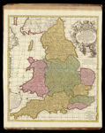
Name: A new mapp of the kingdome of England, representing the princedom of Wales, and other provinces, cities, market towns, with the roads from town to town. And the number of reputed miles between them, are given by inspection without scale or compass.
Barcode:
Image Number:
Creator:
Date Created: 1700 - 1715
Notes: Cartouch says Petrum Schenk Jun. (Peter Schenk II?) Lower right hand corner says printed and sold by Nicholas Visscher and John Overton. This map is listed in several citations of atlases from questionable dates in the late 17th century that reside in the Library of Congress and British Library. The map has a dedication to William III, who was King of England, Scotland, France, and Ireland from 1689 until 1702, dates that coincide perfectly the the careers of Visscher and John Overton, the bookseller cited on the map. The only discrepancy is with attribution of publication to "Petrum Schenk Jun." Peter Schenck I was a contemporary of William III, Nicolas Visscher II, and John Overton, but Peter Schenck II was younger. This map could have been published by the younger Schenck after the lives of all the other people named on the map.
Permanent URL: