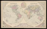
Gray's New Map of the World in Hemispheres, with comparative views of the heights of the principal mountains and lengths of the principal rivers on the globe. By Frank A. Gray.
↑ Parent: Colby's Atlas of the State of Maine : including statistics and description of its history, educational system, geology, railroads, natural resources, summer resorts and manufacturing interests compiled and drawn from official plans and actual surveys and published by Colby & Stuart
Collection:
Osher Collection
Name: Gray's New Map of the World in Hemispheres, with comparative views of the heights of the principal mountains and lengths of the principal rivers on the globe. By Frank A. Gray.
Barcode: 3749
Image Number: 3749.0055
Creator: Colby & Stuart
Printmaker: Bourquin, Fredrick & Co.Bracher, Wm. (William)
Date Published: 1887
Full Title: Gray's New Map of the World in Hemispheres, with comparative views of the heights of the principal mountains and lengths of the principal rivers on the globe. By Frank A. Gray.
Publisher: Colby & Stuart
Language: English
Permanent URL:
https://oshermaps.org/map/3749.0055