

↑ Parent: The Rand McNally New Reference Atlas of the World and the War
Collection: Osher Map Library Collection
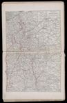
Name: Rand McNally war map of the British Front a strategic map of the battle ground in Belgium and France from Ostend to St. Quentin
Barcode:
Image Number:
Creator:
Permanent URL: