

↑ Parent: Carey's American Atlas: containing Twenty Maps and One Chart.
Collection: Smith Collection
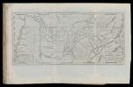
Name: A Map of The Tennassee State formerly Part of North Carolina taken Chiefly from Surveys by Genl. D. Smith. & others J.T. Scott Sculp.
Barcode:
Image Number:
Creator:
Date Created:
Date Published:
Publisher:
Language:
Region Depicted:
Dimensions: H 37.5 x W 57.7 cm
Subjects:
Permanent URL: