

Collection: Flaherty Collection
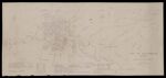
Name: Map of the city of Westbrook Maine compiled from the city sewer map
Barcode:
Image Number:
Surveyor:
Publishing Location:
Date/Date Range Produced: 1930
Language:
Map Type:
Dimensions: 49 x 110 cm
Brief Description: Map shows populations in the wards. Also included are mills, factories, water supplies. Includes years of town and city incorporation and charters.
LC Call Number: G3734.W5 F6 1930
OCLC: 1004393961
Accession Number: FLA-1930-186
Donor:
Permanent URL: