Showing 95121-95130 of 114487 results

Sort By:

Text (blank) page 7
Text (blank) page 7
Content:
Image Number:


Back cover
Back cover
Content:
Image Number:


Portfolio of excursion routes : by rail, stage, and river and ocean steamers as furnished by management of the Worcester & Nashua Railroad, Portland & Worcester Line.
Publisher:
Language:
Type:
Dimensions: 13 x 8 cm
LC Call Number: HE 2725 1881.S6
OCLC: 1535747098
Accession Number: OML-1881-104
Image Number:


A series of maps to Willard's History of the United States : or republic of America. Designed for schools and private libraries
Author:
Publisher:
Date Produced: 1828
Language:
Dimensions: 29 x 23 cm
LC Call Number: E178.1 .W56
OCLC: 3751839
Accession Number: OML-1828-27
Subjects:
Image Number:


Front cover
Front cover
Content:
Image Number:


Text (blank) Page 1
Text (blank) Page 1
Content:
Image Number:


Text (blank) Page 2
Text (blank) Page 2
Content:
Image Number:


Locations and Wanderings of the Aboriginal Tribes
Creator:
Date Created: 1828
Content:
Alternative Title: Introductory Map, to accompany Willard's History of the United States.
Region Depicted:
Image Number:


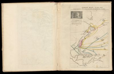
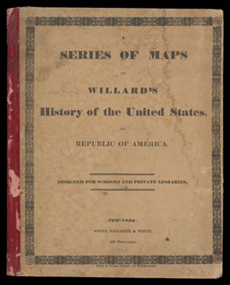
First Map or Map of 1578. To accompany Willard's History of the United States.
Creator:
Date Created: 1828
Content:
Publisher:
Language:
Brief Description: Inset: Queen Elizabeth signs for Sir Humphrey Gilbert. The first patent granted by an English Sovereign to lands within the terittory of the United States 1578. Sir Humphrey Gilbert was an English soldier and navigator, pioneer in English colonial empire.
Image Number:


Second Map or Map of 1620. To accompany Willard's History of the United States.
Creator:
Date Created: 1828
Content:
Publisher:
Language:
Region Depicted:
Brief Description: Insets: The Pilgrims Land at Plymouth on the 22nd. of Dec. 1620. / Places near the Mouth of the Hudson visited by the Dutch.
Image Number: