[expand title="EXHIBIT NAVIGATION"] Stately Cartography: Fifty Maps of Fifty States 1. State Maps of the Early Republic 2. Mitchell Maps 3. Asher & Adams Maps 4. Rand McNally Maps 5. National Geographic Maps 6. National Highways Associatio...
[expand title="EXHIBIT NAVIGATION"] Stately Cartography: Fifty Maps of Fifty States 1. State Maps of the Early Republic 2. Mitchell Maps 3. Asher & Adams Maps 4. Rand McNally Maps 5. National Geographic Maps 6. National Highways Associatio...
[expand title="EXHIBIT NAVIGATION"] Stately Cartography: Fifty Maps of Fifty States 1. State Maps of the Early Republic 2. Mitchell Maps 3. Asher & Adams Maps 4. Rand McNally Maps 5. National Geographic Maps 6. National Highways Associatio...
[expand title="EXHIBIT NAVIGATION"] Stately Cartography: Fifty Maps of Fifty States 1. State Maps of the Early Republic 2. Mitchell Maps 3. Asher & Adams Maps 4. Rand McNally Maps 5. National Geographic Maps 6. National Highways Associatio...
[expand title="EXHIBIT NAVIGATION"] Stately Cartography: Fifty Maps of Fifty States 1. State Maps of the Early Republic 2. Mitchell Maps 3. Asher & Adams Maps 4. Rand McNally Maps 5. National Geographic Maps 6. National Highways Associatio...
[expand title="EXHIBIT NAVIGATION"] Stately Cartography: Fifty Maps of Fifty States 1. State Maps of the Early Republic 2. Mitchell Maps 3. Asher & Adams Maps 4. Rand McNally Maps 5. National Geographic Maps 6. National Highways Associatio...
[expand title="EXHIBIT NAVIGATION"] Stately Cartography: Fifty Maps of Fifty States 1. State Maps of the Early Republic 2. Mitchell Maps 3. Asher & Adams Maps 4. Rand McNally Maps 5. National Geographic Maps 6. National Highways Associatio...
[expand title="EXHIBIT NAVIGATION"] Stately Cartography: Fifty Maps of Fifty States 1. State Maps of the Early Republic 2. Mitchell Maps 3. Asher & Adams Maps 4. Rand McNally Maps 5. National Geographic Maps 6. National Highways Associat...
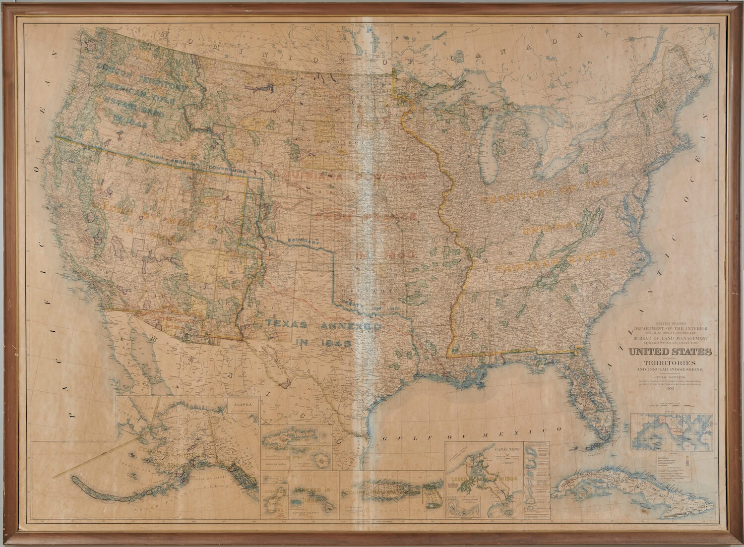
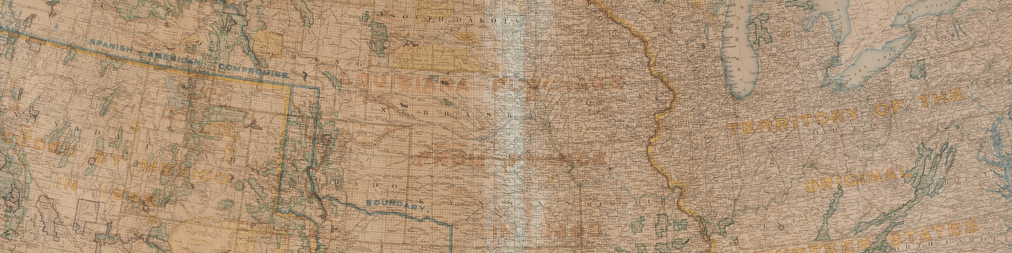
November 1, 2018 ~ March 30, 2019 ... This exhibition features fifty individual maps of the fifty states that comprise the United States of America. While we are used to encountering individual maps of the towns, cities, counties, and states where ...
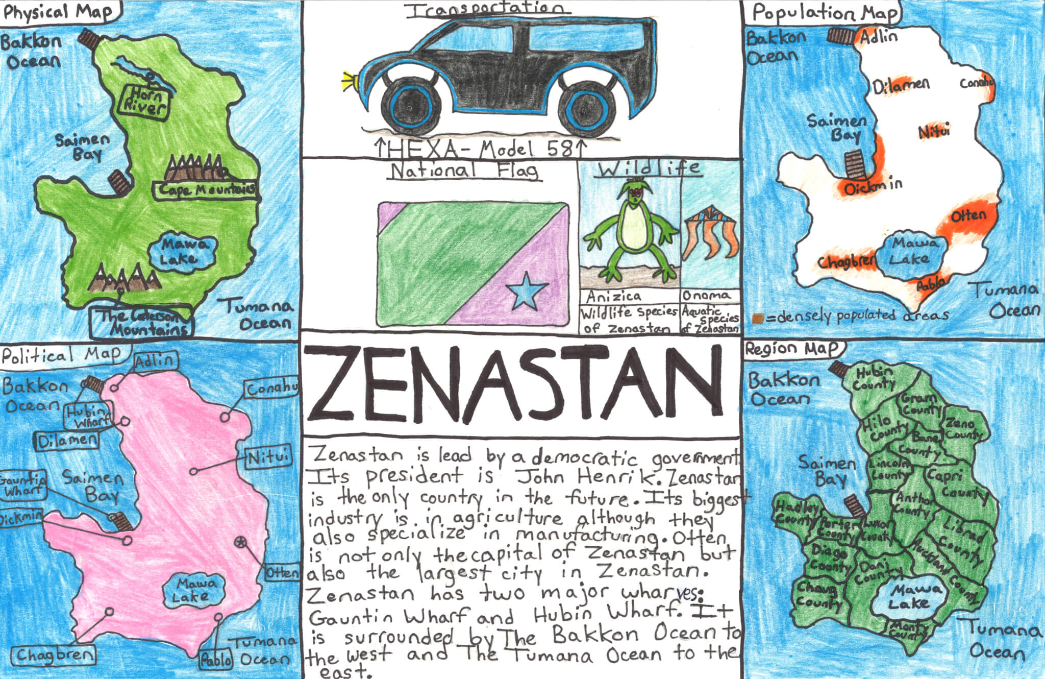
2018 Mapmaking Contest Submissions 1. "Zenastan"Griffin M. (Winner!)Ellsworth Elementary Middle School 2. "Sea Fever"Liam H. (Top Ten!)Brooksville Elementary. 3. "Bouquet of the USA"Ella D. (Top Ten!)Center Drive School. 4. "The Land ...