Sort By: Relevance Order Ascending Order Descending Date Ascending Date Descending Title A-Z Title Z-A
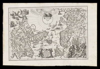
![Deliniatio cartae trium navigationum per Batavos ad Septentrionalem plagem Norvegia Moscovia et Novae Zembla et perque fretum Weygatis Nassoveam dictum acjuxta Groenlandian Sub altitudine 80 graduum nec non adiacentium partium Tartaria promotarij Tabin freti Anjun a[?] rigionis Bargi et partis Americae versus orientem Autore Wilhelmo Bernardo Amstelredam Expertisimo Pilota](https://cdn1.historyit.com/iiif/2/5f34291499c4a6.60628694/6423100e771212.19895844.jpg/full/!400,400/0/default.jpg?no_errors=1)