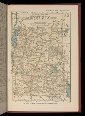
Atlas of Bennington County, Vermont, form the actual Surveys by and underthe direction of F.W. Beers assisted by Geo. P. Sanford & others
Author: Beers, F. W. (Frederick W.)Publisher: F.W. Beers, A.D. Ellis & G.G. SouleDate Produced: 1869
Language: EnglishPhysical Description: 30 leaves (chiefly illustrations, color maps) 41 cm
LC Call Number: G1228.B4 B4 1869
OCLC: 7021342
Accession Number: OS-1869-26
Donor: OsherImage Number: 40679.0001
![Catharine M. Cook's Book of Penmanship At Mr. Dunham's School Windsor Vermont June 15th. 1818. [Front cover]](https://cdn1.historyit.com/iiif/2/5f34291499c4a6.60628694/65b2c5e03657a1.25318582.jpg/full/!400,400/0/default.jpg?no_errors=1)
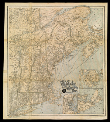
![The official map of southern New England : comprising Massachusetts, Connecticut, and Rhode Island [VERSO] The Official Map of Vermont and New Hampshire](https://odyssey.historyit.com/img/thumbnail/Map.png?no_errors=1)