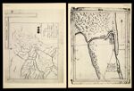
[Plate XLI] A Map Exhibiting the Territorial limits of several Nations & Tribes of Indians agreeably to the notes of A. Chouteau. reduced & laid down on a scale of 80 miles to the inch, by R. Paul February 1816 [1942 copy of 1816 original]
↑ Parent: Indian Villages of the Illinois country. Part 1, Atlas
Collection:
Osher Map Library Collection
Name: [Plate XLI] A Map Exhibiting the Territorial limits of several Nations & Tribes of Indians agreeably to the notes of A. Chouteau. reduced & laid down on a scale of 80 miles to the inch, by R. Paul February 1816 [1942 copy of 1816 original]
Barcode: 14437
Image Number: 14437.0040
Creator: Paul, René, 1783-1851Smith, CaptainTucker, Sara Jones
Date Created: 1818
Date Published: 1818
Alternative Title: [Plate XLII] Map of Chicago River Capt. Smith 1818 [1942 copy of 1818 original][name and date on back of map]
Physical Description: Descriptive information about this facsimile can be found within the notes section of this volume which can be found from images 14437.0009 to 14437.0016
Notes: 1816 - inscribed on map; 1818 - inscribed on map
Permanent URL:
https://oshermaps.org/map/14437.0040