

↑ Parent: Indian Villages of the Illinois country. Part 1, Atlas
Collection: Osher Map Library Collection
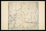
Name: [Plate LII] Map of the Boundary Line between Ceded and Unceded Lands surveyed under the direction of the Hon. J. H. Eaton, Sec. of War, conformably to the stipulations of the Treaty of Prairie du Chien of 1829. By Lucius Lyon of Detroit Mich. Ter.[1942 copy of circa 1830 original]
Barcode:
Image Number:
Creator:
Date Created:
Date Published:
Physical Description: Descriptive information about this facsimile can be found within the notes section of this volume which can be found from images 14437.0009 to 14437.0016
Permanent URL: