Previous Page         Next Page

North America from the French of Mr. D'Anville Improved with The English Surveys made Since the Peace


↑ Parent: The American atlas or, A geographical description of the whole continent of America. Wherein are delineated at large, its several regions, countries, states, and islands and chiefly the British colonies. Engraved on 48 copper-plates, by Thomas Jefferys and others

Collection: Smith Collection

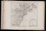
Name: North America from the French of Mr. D'Anville Improved with The English Surveys made Since the Peace

Barcode:

Image Number:

Creator:

Date Published: Jun 10th, 1775

Content:

Publisher:

Language:

Region Depicted:

Dimensions: Map: H 46 x W 51 cm on sheet: H 54.5 x W 75.5 cm

Printing Process:

Printing Technique:

Permanent URL: