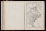
A Map of the British Empire in North America; by Samuel Dunn, Mathematician.
↑ Parent: The American atlas or, A geographical description of the whole continent of America. Wherein are delineated at large, its several regions, countries, states, and islands and chiefly the British colonies. Engraved on 48 copper-plates, by Thomas Jefferys and others
Collection:
Smith Collection
Name: A Map of the British Empire in North America; by Samuel Dunn, Mathematician.
Barcode: 1986
Image Number: 1986.0028
Creator: Jefferys, Thomas, 1710-1771
Date Published: Jan 10th, 1774
Content: Graphic
Full Title: A Map of the British Empire in North America; by Samuel Dunn, Mathematician. London: Printed for Robt. Sayer, No. 53 in Fleet Street. as the Act directs 10 January 1774.
Publisher: Robert Sayer and John Bennett (Firm)
Language: English
Region Depicted: Eastern United States
Dimensions: Map: H 47.5 x W 30.3 cm on sheet: H 54.5 x W 41 cm
Permanent URL:
https://oshermaps.org/map/1986.0028