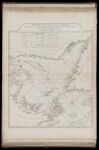
A Chart of the Gulf of St. Laurence, Composed from a Great Number of Actual Surveys and Other Materials, Regulated and Connected by Astronomical Observations.
↑ Parent: The American atlas or, A geographical description of the whole continent of America. Wherein are delineated at large, its several regions, countries, states, and islands and chiefly the British colonies. Engraved on 48 copper-plates, by Thomas Jefferys and others
Collection:
Smith Collection
Name: A Chart of the Gulf of St. Laurence, Composed from a Great Number of Actual Surveys and Other Materials, Regulated and Connected by Astronomical Observations.
Barcode: 1986
Image Number: 1986.0033
Creator: Jefferys, Thomas, 1710-1771
Date Published: May 25th, 1775
Content: Graphic
Subjects: Navigation
Publisher: Robert Sayer and John Bennett (Firm)
Language: English
Region Depicted: Gulf of Saint LawrenceNewfoundland and LabradorNova Scotia
Dimensions: Map: H 61 x W 49.5 cm on sheet: H 75.5 x W 54.5 cm
Printing Process: Engraving
Printing Technique: Copper
Permanent URL:
https://oshermaps.org/map/1986.0033