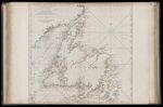
A General Chart of the Island of Newfoundland with the Rocks & Soundings. Drawn from Surveys taken by James Cook and Michael Lane, Surveyors.
↑ Parent: The American atlas or, A geographical description of the whole continent of America. Wherein are delineated at large, its several regions, countries, states, and islands and chiefly the British colonies. Engraved on 48 copper-plates, by Thomas Jefferys and others
Collection:
Smith Collection
Name: A General Chart of the Island of Newfoundland with the Rocks & Soundings. Drawn from Surveys taken by James Cook and Michael Lane, Surveyors.
Barcode: 1986
Image Number: 1986.0037
Creator: Jefferys, Thomas, 1710-1771
Date Published: May 10th, 1775
Content: Graphic
Surveyor: Cook, James, 1728-1779Lane, Michael, active 1768-1784
Publisher: Robert Sayer and John Bennett (Firm)
Language: English
Region Depicted: Newfoundland and Labrador
Dimensions: Map: H 54.5 x W 55.5 cm on sheet: H 55 x W 75.5 cm
Printing Process: Engraving
Printing Technique: Copper
Permanent URL:
https://oshermaps.org/map/1986.0037