
March 30, 2017 ~ October 28, 2017 ... Americans relied on printed images to understand World War I before and after the US entered the war in April 1917. Their understanding of Germany as an enemy was shaped by propaganda maps and posters, while ne...
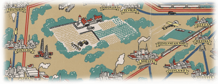
April 7, 2016 ~ September 3, 2016 ... Curated by Dr. Stephen J. Hornsby, co-editor of the Historical Atlas of Maine and author of a forthcoming book on American pictorial maps, this exhibit looks at the golden age of pictorial or illustrated maps...
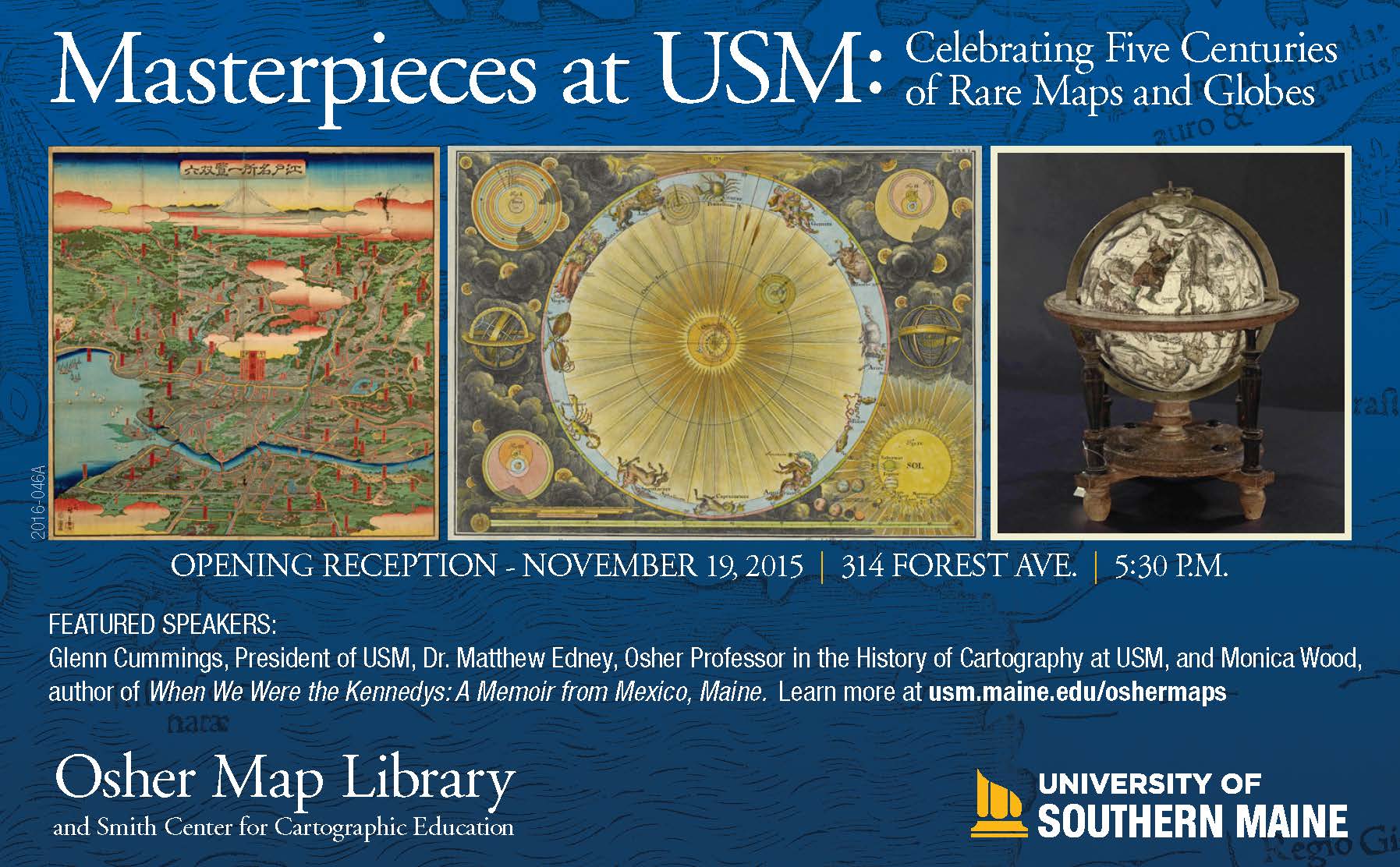
November 19, 2015 ~ March 12, 2016 ... Curated by the OML staff and some of Maine's very own luminaries, including renowned authors, Susan Minot and Monica Wood, as well as Senator Angus King, Senator Susan Collins, Congresswoman Chellie Pingree, amo...

August 7, 2015 ~ September 28, 2015 ... Staying the Course: Working Women of Portland's Waterfront will open at the Portland Public Library's Lewis Gallery on First Friday, August 7, 2015 at 5 pm. The exhibit explores the diverse roles and storie...
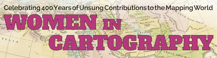
March 26, 2015 ~ October 22, 2015 ... This exhibition recognizes and celebrates the long overlooked role of women in the world of mapping; bringing their stories, accomplishments, and most importantly their maps to light. Curated by Alice Hudson, for...
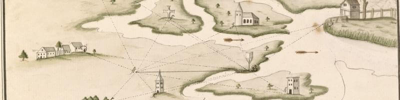
October 16, 2014 ~ February 26, 2015 ... Hand-drawn maps are works of art, both in the modern sense of aesthetic design and in the older sense of craft and skill. Also known as manuscripts ~ from the Latin for written (script) by hand (manu) ~ hand-d...
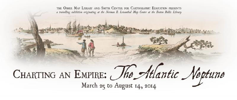
March 25, 2014 ~ August 14, 2014 ... OML is pleased to present a subset of Charting an Empire, the two-part exhibition curated by Stephanie Cyr and Ronald E. Grim and originally installed in 2013 at the Norman B. Leventhal Map Center of the Boston ...
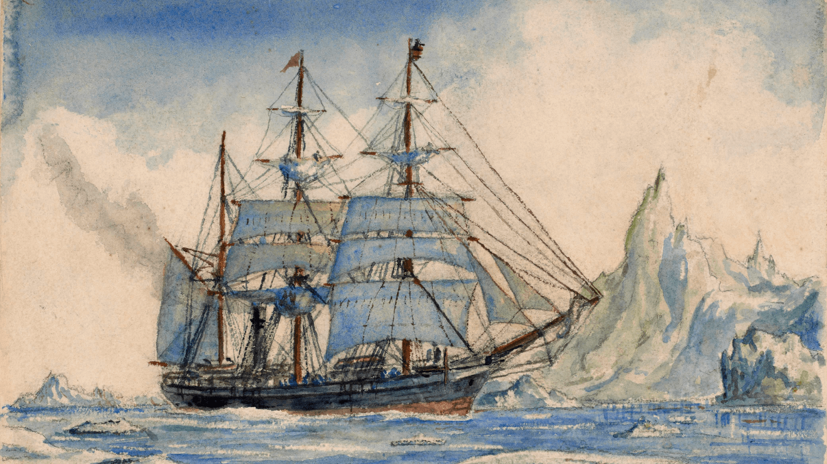
September 24, 2013 ~ February 27, 2014 ... OML is pleased to present To the Ends of the Earth... and Back: Selections from the Jay I. Kislak Polar Collection, an exhibition curated by Arthur Dunkleman, Director of the Jay I. Kislak Foundation, Miami ...
April 2, 2013 to August 24, 2013 ... OML is pleased to present, as part of the 2013 Maine Civil War Trail, a subset of the exhibition of the same name, curated by Dr. Ronald E. Grim and originally installed in 2011 at the Norman B. Leventhal Map Ce...
September 11, 2012 ~ February 28, 2013 ... Highlights from the Fondersmith Collection of Cartographic Ephemera John Fondersmith, guest curator The symbolic use in modern American culture of the outline map of the United States of America is so wi...