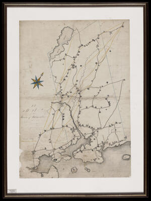
Osher Map Library Sheet Map Collection

4,670 results

The Game of American Tours.
Publisher:
Language:
Region Depicted:
Map Type:
Dimensions: 48 x 75 cm
LC Call Number: GV1469.A54 G54 1933
OCLC: 1370610890
Accession Number: OML-1933-106
Subjects:
The Game of American Tours.

Gallup, New Mexico, the Indian capital
Printmaker:
Language:
Region Depicted:
Map Type:
Dimensions: 57 x 41 cm
LC Call Number: G4321.A5 1940 E95
OCLC: 810337681
Accession Number: OML-1940-250
Subjects:
Gallup, New Mexico, the Indian capital

A Pictorial Map of Scenes in and around Army-Slang designed and published by Ernest Dudley Chase collaborating with Stephen York.
Printmaker:
Language:
Map Type:
Dimensions: 38 x 54 cm on sheet 40 x 58 cm folded to 20 x 10 cm
Historical Context: This pictorial map was done two years after the United States entered the war after Pearl Harbor was attacked by Japan.
LC Call Number: G3401.S7 1943 C4
OCLC: 1412258708
Accession Number: OML-1943-173
Subjects:
A Pictorial Map of Scenes in and around Army-Slang designed and published by Ernest Dudley Chase collaborating with Stephen York.

[Map of Turan]
Printmaker:
Date/Date Range Produced: 1967
Language:
Map Type:
Dimensions: 24 x 35 cm in frame 38 x 49 cm
Printing Technique:
LC Call Number: G9930 1967.C4
OCLC: 1413972775
Accession Number: OML-1967-188
[Map of Turan]

Plan of lots of Lem Peters, Daniel Osgood & Elisha Wood meadowland & c.
Surveyor:
Date/Date Range Produced: Oct 24th, 1839 - Jan 7th, 1860
Language:
Region Depicted:
Map Type:
Dimensions: 40 x 34 cm + 26 x 17 cm attachment
LC Call Number: G3734.B57 1839 D6
OCLC: 1416367428
Accession Number: OML-1839-57
Plan of lots of Lem Peters, Daniel Osgood & Elisha Wood meadowland & c.

Great Cranberry Island
Surveyor:
Date/Date Range Produced: 1790
Language:
Region Depicted:
Map Type:
Dimensions: 21 x 34 cm
LC Call Number: G3733.H3 1790 P4
OCLC: 1416493403
Accession Number: OML-1790-30
Great Cranberry Island

Cold River Camp A. M. C.
Creator:
Date/Date Range Produced: 1950
Language:
Region Depicted:
Dimensions: H 27.8 X W 21.7 cm
Accession Number: OML-1950-246
Donor:
Donation Date: Feb 15th, 2022
Cold River Camp A. M. C.

A map of the town of Falmouth survey taken in March 1828, John M. Wilson Surveyor.
Surveyor:
Date/Date Range Produced: 1828
Language:
Region Depicted:
Dimensions: 106 x 76 cm in frame 126 x 94 cm
LC Call Number: G3734.F3 1828 W5
Accession Number: OML-1828-31
Donor:
Subjects:
A map of the town of Falmouth survey taken in March 1828, John M. Wilson Surveyor.

John Pray, his land
Surveyor:
Date/Date Range Produced: 1794
Language:
Region Depicted:
Map Type:
Dimensions: 35 x 51 cm
Printing Technique:
LC Call Number: G3734.A3 1794 D6
OCLC: 1416853572
Accession Number: OML-1794-33
John Pray, his land

Plan: R.G.W. Dodge
Surveyor:
Date/Date Range Produced: 1841 - 1842
Language:
Region Depicted:
Map Type:
Dimensions: 39 x 33 cm
Printing Technique:
LC Call Number: G3734.E5 1842 D6
OCLC: 1416903047
Accession Number: OML-1842-25
Plan: R.G.W. Dodge