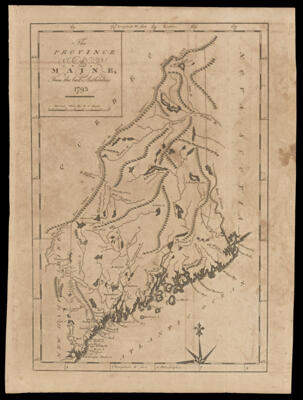
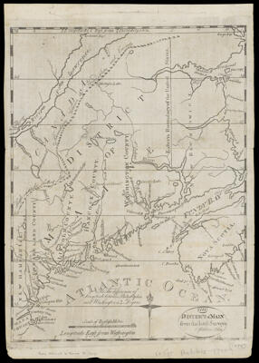
The District of Main from the latest Surveys O. Carleton, delinCreator:Carleton, Osgood, 1742-1816 Atlas Reference:The American Universal Geography (Boston, 1793) Publisher:Carleton, Osgood, 1742-1816 Date/Date Range Produced: 1793 Language:English Region Depicted:Maine Map Type:Geographical Dimensions: 27 x 21 cm Printing Process:Engraving Material Type:Paper Historical Context: Osgood Carleton (1741-1816) was the key figure in the early mapping of the Eastern District of the Commonwealth of Massachusetts: Maine. A land surveyor and teacher of the mathematical arts in Boston, he compiled existing manuscript maps and plans into maps of the district for books on U.S. geography and Maine history, in 1793 and 1795 respectively. These were the first printed maps of Maine. LC Call Number: G3730 .C3 1795 OCLC: 138098799 Accession Number: SM-1795-17 Donor:Smith