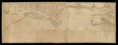
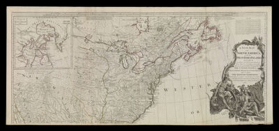
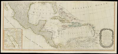
A New Map of North America, with the West India Islands. Divided according to the preliminary Articles of Peace, signed at Versailles, 20, Jan. 1783. wherein are particularly distinguished the United States, and the several provinces, governments & ca. which compose the British Dominions, laid down according to the latest surveys, and corrected from the original materials, of Governor Pownall, Member of Parliament
Creator: Bowen, Emanuel, 1693 or 1694-1767Gibson, J. (John), active 1750-1792Publisher: Laurie & WhittleLanguage: EnglishDimensions: top sheet: 49 x 115 cm on sheet 54.5 x 121.5 cm lower sheet: 49 x 114.5 cm on sheet 54 x 120.5 cm
joined: 98 x 121.5 on sheet 108.5 x 121.5 cm
Printing Process: EngravingMaterial Type: PaperAccession Number: OS-1794-19
Donor: OsherSubjects: ColonizationIndigenous peoplesNative American tribesTurtle Island