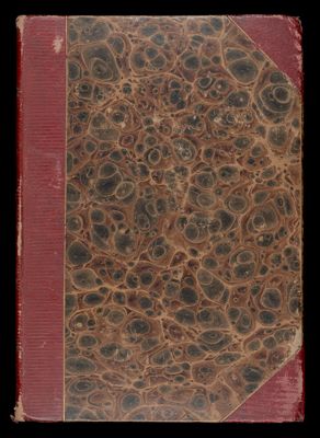
Osher Map Library Atlas Collection

785 results

A New Pocket Atlas of the United States with the roads and distances, designed for the use of travellers by H.S. Tanner
Author:
Date Produced: 1828
Language:
Dimensions: Height: 15
Physical Description: 1 book: [2] pages, [12] leaves of plates, color maps (maps hand colored in outline)
LC Call Number: G1201.P2 .T3 1828
OCLC: 8400486
Accession Number: OML-1828-5
A New Pocket Atlas of the United States with the roads and distances, designed for the use of travellers by H.S. Tanner

Maine Farmer Handy Atlas of the World : containing New Maps of each State and Territory in the United States and of every Country in the World
Date Produced: 1910
Language:
Dimensions: 21 cm
Physical Description: 1 atlas: 114 pages, colored maps
LC Call Number: G1019 .M33 1910
OCLC: 43545167
Accession Number: OML-1910-13
Maine Farmer Handy Atlas of the World : containing New Maps of each State and Territory in the United States and of every Country in the World

[Manuscript Atlas]
Author:
Date Produced: 1860
Dimensions: Cover: H 28.4 X W 24 cm, Pages: H 27.9 X W 22.2 cm
Accession Number: OML-1860-51
Subjects:
[Manuscript Atlas]

[Manuscript Atlas]
Author:
Date Produced: 1774
Language:
Dimensions: Cover: H 16.3 X W 11.1 cm, Pages: H 15.6 X W 10.3 cm
Physical Description: Small manuscript atlas with 19 colored maps, hand drawn and colored cartouches with a handwritten presentation: "M. A. Fortescue from her dear Grandmama Fortescue Glyde Farm 1821 Made by my dear Papa in the year 1794"<br /><br />This manuscript inscription indicates that this book was gifted to Martha Ann (Fortescue) Hamilton by her grandmother Mary (Nicholson) Fortescue in 1821 when Martha was 10-11 years old. The inscription was written by Mary not Martha. The most direct evidence for this is that the phrase "Made by my dear Papa in the year 1794" was corrected from the original "Made by <strong>her</strong> dear Papa in the year 1794." Martha's father was Chichester Fortescue, and if you look clearly at the faint penciled inscription on the front pastedown you can see the phrase "Maps[?] by Chichester Fortescue."<br /><br />Maps include cartouches with emphasis on the British flag which is prominently featured atop the world map. Highlights of the cartouches: Map of France: Skeleton waving a sword standing next to guillotine and underneath is a coffin. Prussia is represented by a soldier casually standing with his sword.
LC Call Number: G1019 1794.M3
OCLC: 941822449
Accession Number: OML-1794-22
Subjects:
[Manuscript Atlas]

[Harriet Lincoln map sketch book]
Author:
Date Produced: 1830
Language:
Dimensions: H 19 x W 27.5 cm
Accession Number: OML-1830-39
Subjects:
[Harriet Lincoln map sketch book]

Insurance maps of Portland, Maine, Volume 1
Publisher:
Language:
Material Type:
Dimensions: Cover: 35.5 x 32 cm, maps: 33 x 28 cm
OCLC: 1046984059
Accession Number: OML-1954-75
Subjects:
Insurance maps of Portland, Maine, Volume 1

 War maps and diagrams.
Publisher:
Language:
Material Type:
Dimensions: Cover: map: 40 x 32 cm on sheet: 52 x 37.5 cm open pages: 52 x 74.5 cm
Historical Context: The American Civil War began on April 12, 1861 and ended on May 26, 1865. the main conflict leading to the war was the dispute over slavery and its expansion to the west. When Abraham Lincoln was elected president in 1860, he opposed the expansion which let to seven southern states to secede from the Union. More southern states joined the secession and became a confederacy electing Jefferson Davis as their president.; The compilation of maps and diagrams depicts the vastness of the conflict with forces on both sides spread out over much of the mid-Atlantic and Southern United States and parts of the Midwest.
LC Call Number: G3701.S5 1861 N4
OCLC: 75544738
Accession Number: OML-1861-130
Subjects:
 War maps and diagrams.

The Rand McNally New Reference Atlas of the World and the War
Author:
Publisher:
Date Produced: 1918
Language:
LC Call Number: G1037 .R363 1918
OCLC: 14633687
Accession Number: OML-1918-27
Subjects:
The Rand McNally New Reference Atlas of the World and the War