A New Map of the United States of America, from the best authorities.CreatorWallis, J. (John), -1818
PublisherWallis, J. (John), -1818
LanguageEnglish
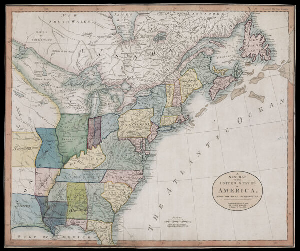
Region DepictedAlabamaArkansasConnecticutDelawareEastern CanadaEastern United StatesFloridaGeorgiaGreat Lakes Region (North America)IllinoisIndianaKentuckyLouisianaMaineMaritime ProvincesMarylandMassachusettsMichiganMinnesotaMississippiMissouriNew HampshireNew JerseyNew York (State)Newfoundland and LabradorNorth CarolinaNova ScotiaOhioOntarioPennsylvaniaRhode IslandSouth CarolinaTennesseeVermontVirginiaWest VirginiaWisconsin
Map TypeGeographicalPolitical maps
DimensionsMap: 46 x 55 cm on sheet: 51.5 x 62 cm
Printing ProcessEngraving
Material TypePaper
Historical ContextThe political independence of the United States was celebrated in several maps published during the Revolution and, like this one, during the Anglo-American peace negotiations. This map weds the territory of the new republic to its high ideals, expressed in the allegorical title-cartouche.
OCLC841170900
Accession NumberOS-1783-3
See AlsoA New Map of the United States of America, from the best authorities.
DonorOsher
SubjectsAmerican Revolution, 1775-1783Colonial settlements in AmericaColonialismIndigenous locationsNative American tribesSettler-colonialism