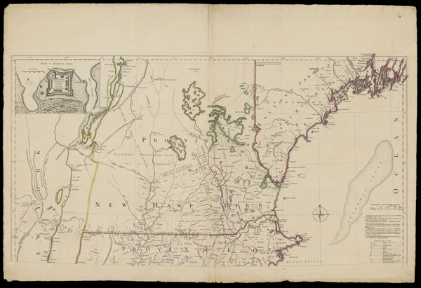
Map of the Most Inhabited Part of New England, containing the Provinces of Massachusetts Bay and New Hampshire, with the Colonies of Konektikut and Rhode Island, Divided into Counties and Townships: The whole composed from Actual Surveys and its Situation adjusted by Astronomical Observations.

Showing 1-1 of 1 results

Sort By:

A Map of the most Inhabited part of New England...

Creator

Date/Date Range Produced1755

Language

Dimensions56 cm. x 44 cm.

Printing Process

Material Type

LC Call NumberG3720 1755 .J4

OCLC5416640

Accession NumberOS-1755-13.2

See Also

Donor