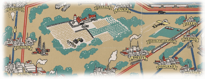

Suchy, a Cleveland commercial artist, produced several maps of his native city and home state. His Ohio map is a masterpiece of design, combining different types of information arranged around a state map and seal, all depicted in subtle muted colors. The calligraphy is particularly striking.
10. Arthur B. Suchy, Ohio. Mother of Presidents. Ohio Buckeye State (1939).
Stephen J. Hornsby Collection
URL: www.oshermaps.org/map/4000162
Published by the Council Against Intolerance in America, this large pictorial map designed in the realist graphic style of the 1930s aimed to teach schoolchildren about the founding peoples; leading figures in contemporary American literature, science, industry, and the arts; the main religious groups; and principal economic activities. Although prominently represented, “Negroes” are not listed as coming from Africa.
11. Emma Bourne, America–A Nation of One People From Many Countries (1940).
Stephen J. Hornsby Collection
URL: www.oshermaps.org/map/4000182
Harris-Intertype Corporation of Cleveland, Ohio, published a dozen pictorial maps for their calendars in the 1950s and early 1960s to advertise the firm’s high quality color printing presses. Commercial artist Edward Everett Henry designed several “portrait maps,” all showing scenes from classic American and British novels. He mastered the difficult challenge of combining map and image, most theatrically in this pictorial map of Moby Dick. The great sweep of the Pequod’s track gives the map a dynamic effect, while the use of red marks the bloody progress and denouement of the whaling voyage.
12. Edward Everett Henry, The Voyage of the Pequod from the Book Moby Dick by Herman Melville (1956).
Stephen J. Hornsby Collection
URL: www.oshermaps.org/map/4000163
Everett Henry’s spiral design, beginning with the railroad tracks in the top right and then curving down the rivers to the Rockies, around to the corral, and ending in the gun fight, combined with Harris-Intertype’s superb color printing, make this a most attractive pictorial map.
13. Edward Everett Henry, The Virginian: From America’s First “Western” Novel Written by Owen Wister (1960).
Stephen J. Hornsby Collection
URL: www.oshermaps.org/map/4000188