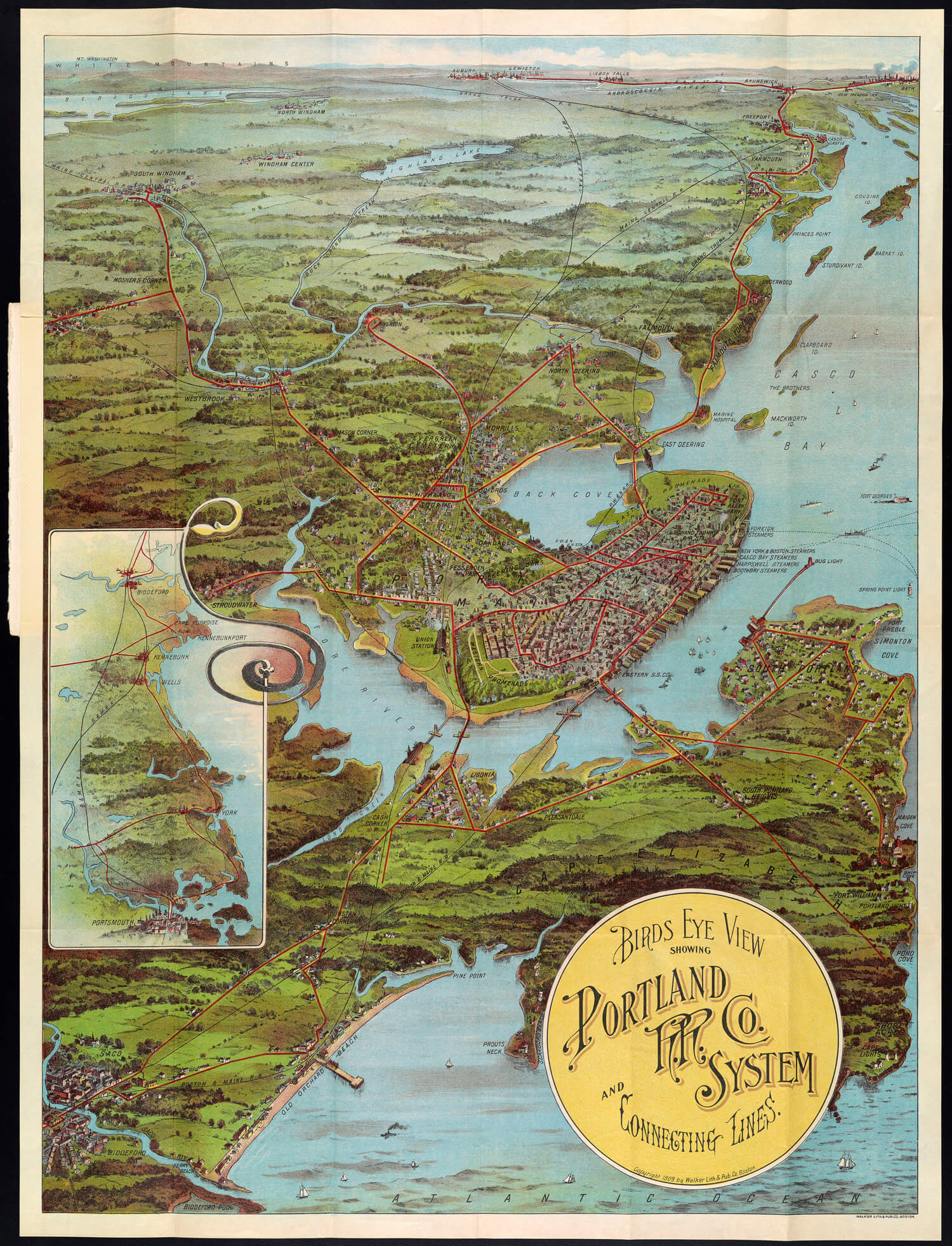
Title: Birds Eye View showing Portland R.R. Co. System and Connecting Lines.
Barcode: 1371
Publisher: Walker Lith. & Pub. Co.,
Historical Context: This 1909 transportation map presents a dramatic bird’s eye view of the greater Portland metropolitan region served by a convenient inter-urban trolley system linking Brunswick, Lewiston, Old Orchard and other destinations. The growth of commuter suburbs and increased ridership of light rail was encouraged by company built terminal station attractions at Riverton Park and Cape Cottage in Cape Elizabeth. Produced by Walker Lithographers of Boston, this colorful map exemplifies the artistry which commercial printing had achieved at the turn of the century.
Brief Description: Pictorial bird’s eye view of Portland, Maine, and neighboring areas. The views shows Saco and Cape Elizabeth north. Bath, Brunswick, Lewiston-Auburn, and the White Mountains are visible on the horizon. Portland Railroad Company routes are shown in red.
Permanent URL: https://oshermaps.org/map/1371.0001
Play below or on jigsawplanet.com: Portland Birds Eye View Puzzle
Directions:
Click on the image to launch the puzzle. The default difficulty setting for this puzzle is fairly easy. For a greater challenge, play on jigsawplanet.com and adjust the number of pieces using the “Play As” button in the upper right-hand corner.