Inspired by our colleagues at Colby College Museum of Art, please enjoy some virtual jigsaw puzzles of maps from our collections! See the inspiration here.
Directions:
Click on the image to launch the puzzle. The default difficulty setting for this puzzle is fairly easy. For a greater challenge, play on jigsawplanet.com and adjust the number of pieces using the “Play As” button in the upper right-hand corner.
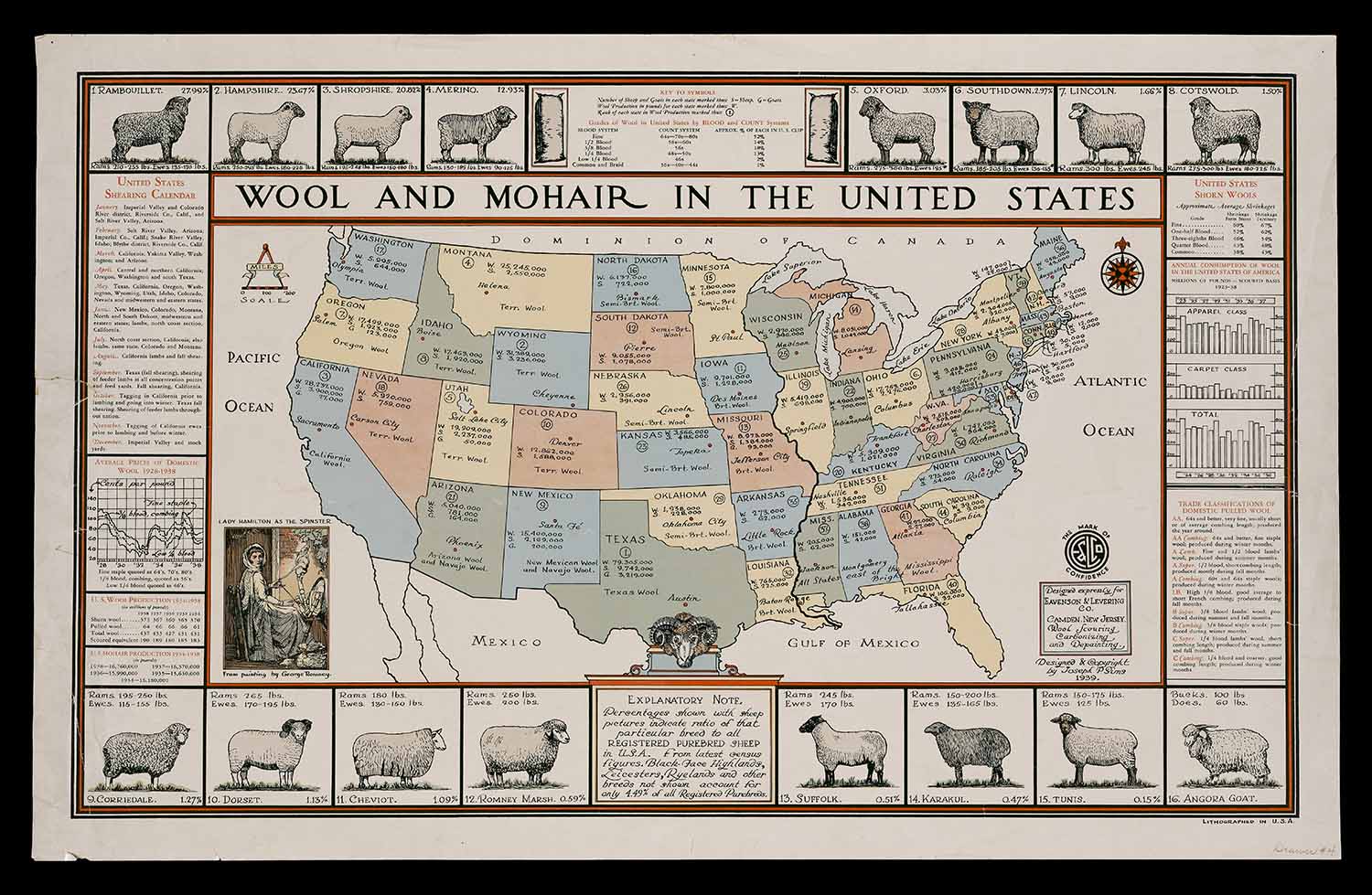
“Wool and mohair in the United States” by Joseph Sims (1936)
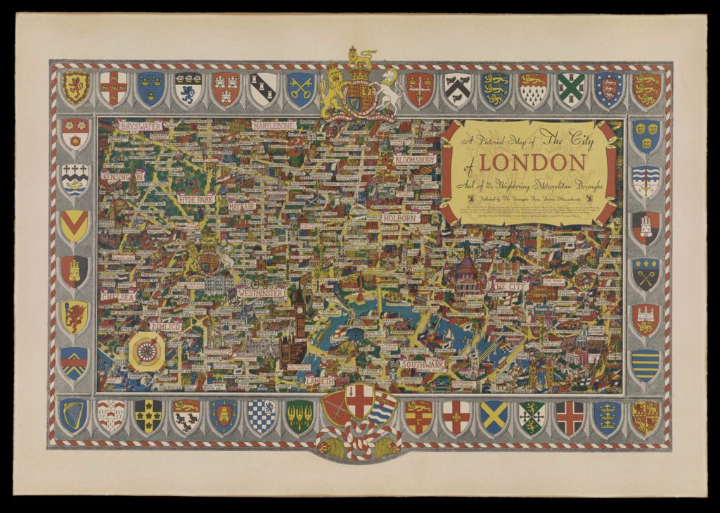
“A Pictorial Map of the City of London…” by Robert Winston Finch (1952)
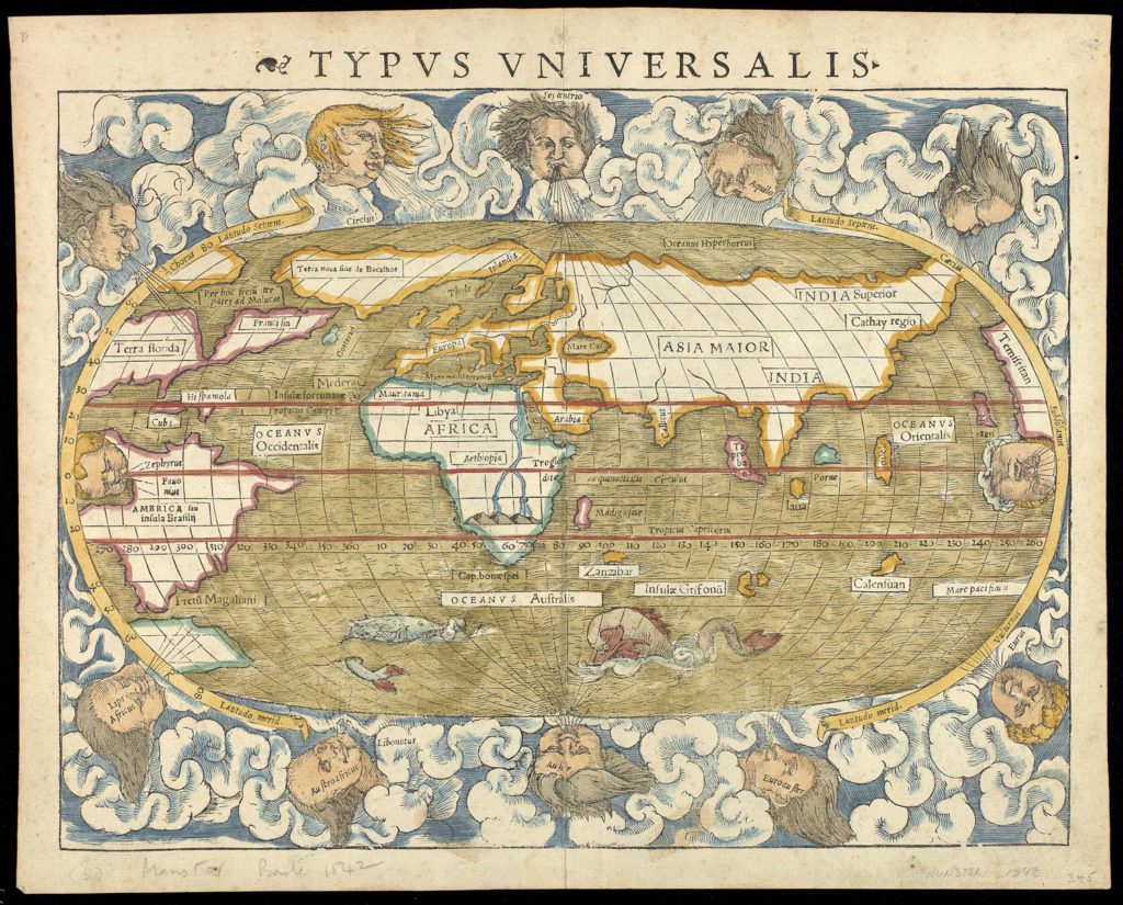
“Typus Universalis” by Sebastian Munster (1542)
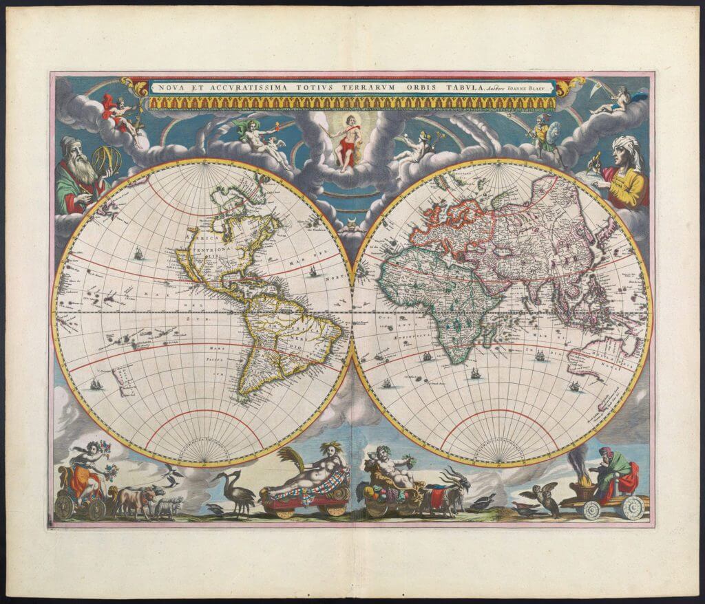
“New and most accurate map of the whole world”by Joan Blaeu (1662)
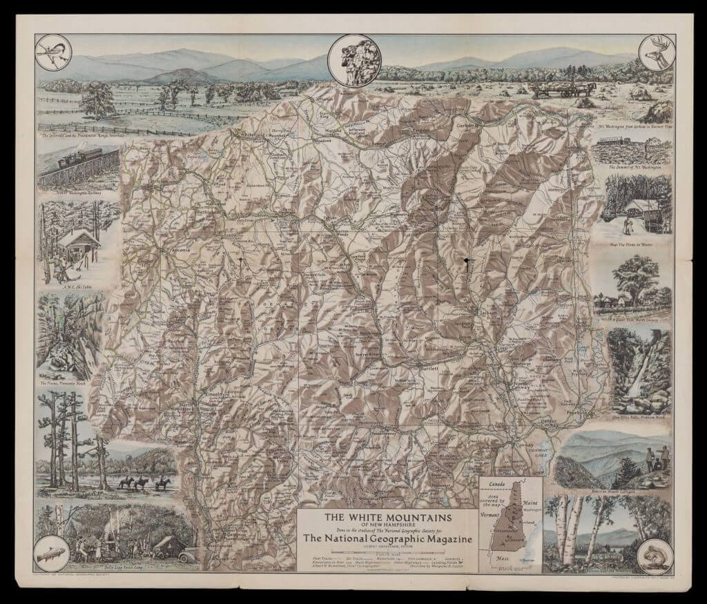
“White Mountains of New Hampshire” from National Geographic (1937)
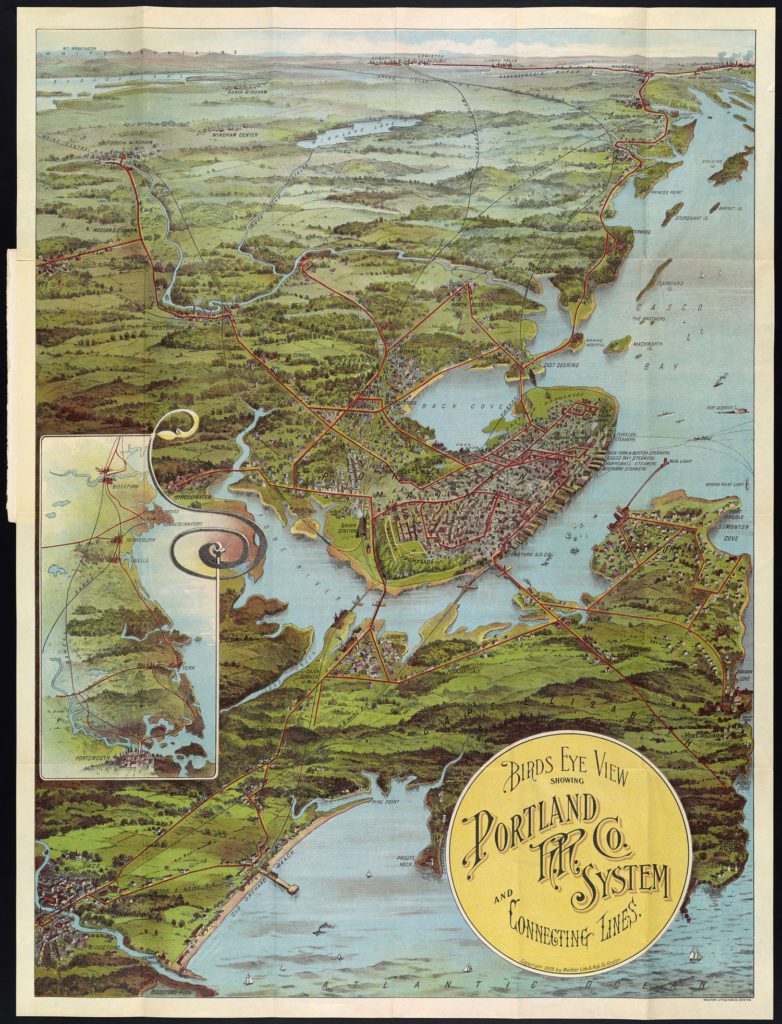
“Birds Eye View Showing Portland” by Walker (1909)
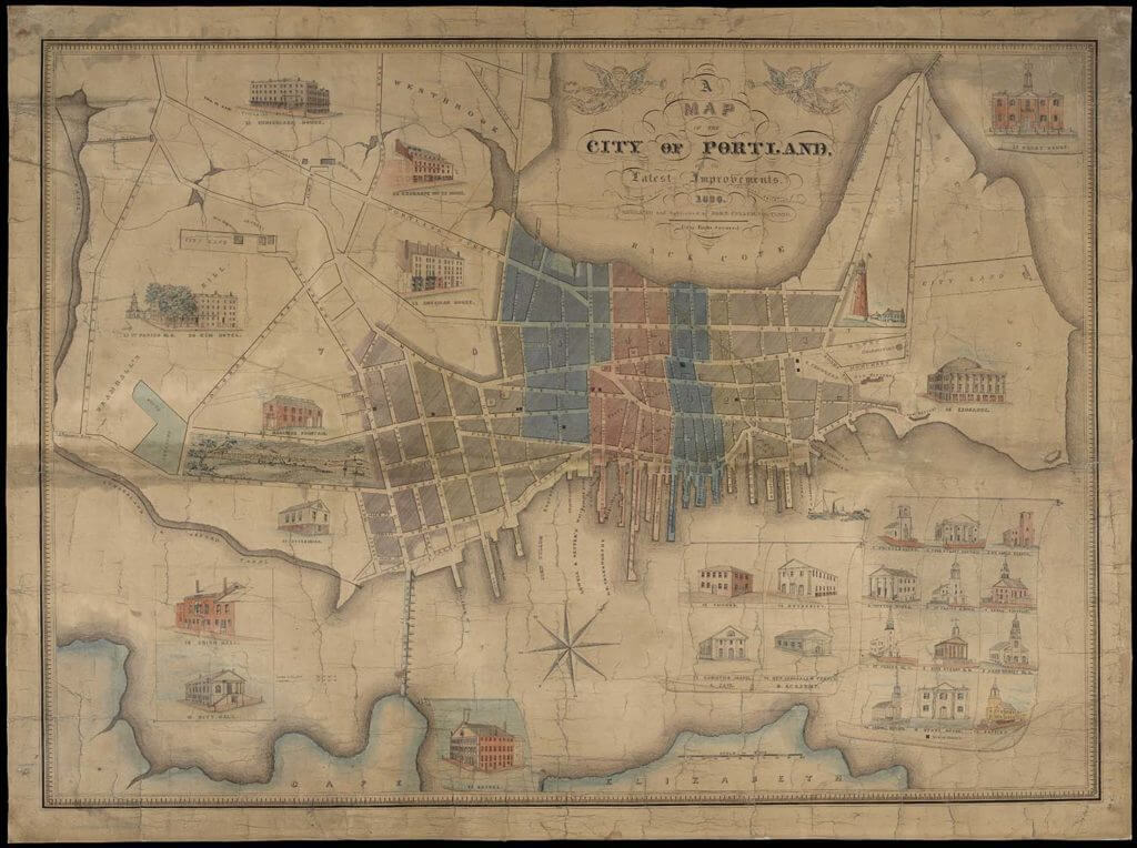
“A Map of the City of Portland” by John Cullum (1836)
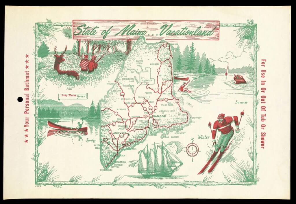
“State of Maine… Vacationland” (circa 1960)
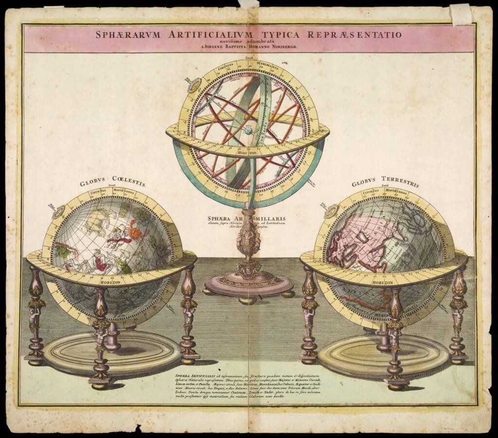
“Sphaerarum Artificialium Typica…” by Homann (1716)
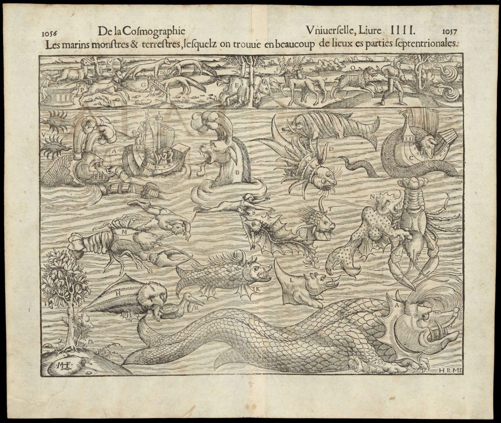
“Les Marins Monstres & Terrestres” by Sebastian Munster (1550)
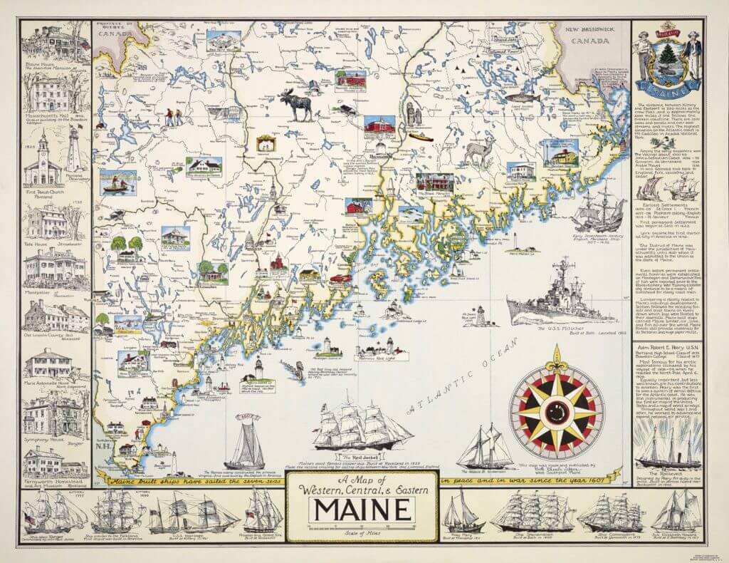
“Map of Western, Central, and Eastern Maine” by Ruth Rhoads Lepper (1952)
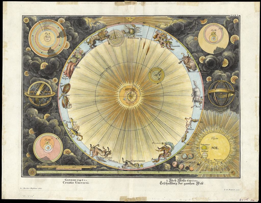
“Creatio Universi,” by Fuesslinus (circa 1720)
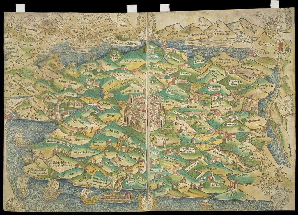
“Palestine” by Lucas Brandis (1475)
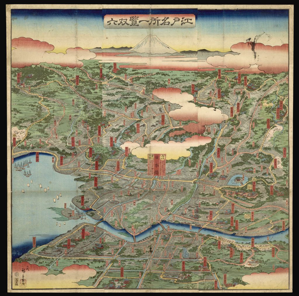
“Edo Meisho Ikken Sugoroku” (circa 1857-1859)
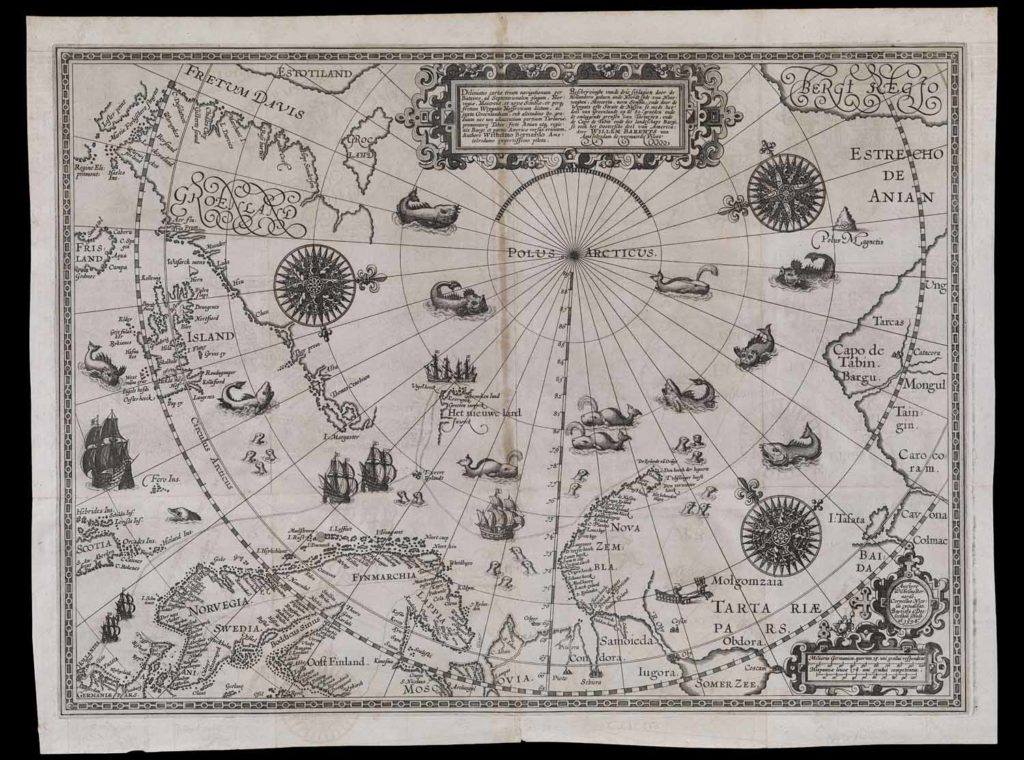
“Deliniatio cartae trium navigationum,” by William Barentsz (1598)
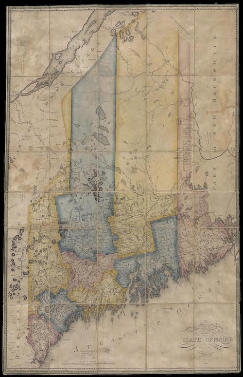
“A Map of Maine” by Moses Greenleaf (1820)