

Collection: Smith Collection
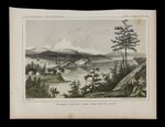
Name: Mt. Baker & Cascade Range from Whitbys Island
Barcode:
Image Number:
Creator:
Date Created:
Date Published:
Content:
Full Title: Reports of Explorations and Surveys, to ascertain the most practicable and economical route for a railroad from the Mississippi River to the Pacific Ocean. Made under the direction of the Secretary of War, in 1853-[6] . Vol. 12 [part 1]
Publisher:
Language:
Dimensions: 22 x 30 cm
Printing Process:
Permanent URL: