

Collection: Osher Map Library Collection
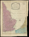
Name: An Accurate Map of the East Part of England with the Parts of Holland and Flanders bordering on the German Ocean.
Barcode:
Image Number:
Creator:
Date/Date Range Produced:
Date/Date Range Published:
Language:
Dimensions: 36 x 28
Printing Process:
Printing Technique:
Material Type:
Notes: From: Universal Magazine, vol. XXVII, November, 1760. Note: "R.W. Seale del. et sculp."
Physical Description: 1 map: color
OCLC: 682920489
Accession Number: OML-1760-7
Permanent URL: