

↑ Parent: Indian Villages of the Illinois country. Part 1, Atlas
Collection: Osher Map Library Collection
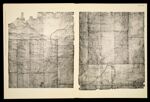
Name: [Plate XLIII] A Map of the Illenois River from its Mouth to Gomo's Village 200 miles St. Louis September 20. 1816 [1942 copy of 1816 original]
Barcode:
Image Number:
Creator:
Date Created:
Date Published:
Notes: 1816 - inscribed on map
Physical Description: Descriptive information about this facsimile can be found within the notes section of this volume which can be found from images 14437.0009 to 14437.0016
Permanent URL: