

Collection: Story Collection
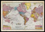
Name: The World on the Mercator Projection
Barcode:
Image Number:
Creator:
Date Created:
Date Published:
Language:
Region Depicted:
Map Type:
Printing Process:
Notes: Includes text, "Note-The Mercator Projection does not permit of a fixed Scale of Miles because of the fact that, to show the face of the Globe on a flat surface, the scale must be greatly extended towards the Poles, both as to latitudinal and longitudinal proportions. The following measurements somewhat illustrate the varying distances[....]"
Shows routes of submarine telegraphic cable lines in red
See Also:
Permanent URL: