


Collection: Osher Collection
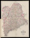
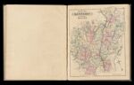
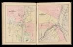
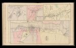
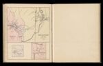
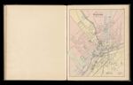
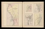
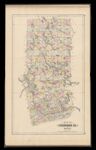
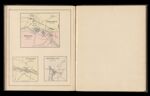
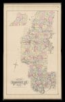
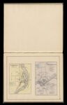
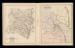
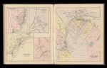
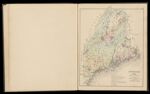
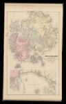
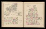
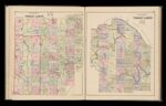
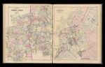
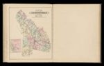
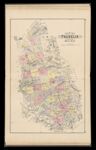
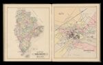
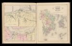
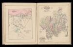
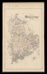
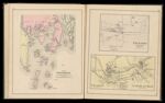
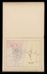
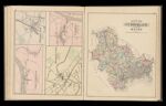
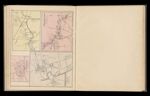
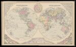
Name: Map of Boothbay and adjacent islands. Drawn from U.S. coast survey charts. / Freeport Village, Cumberland Co. / Saccarappa & Cumberland Mills, Cumberland County.
Barcode:
Image Number:
Permanent URL:
Creator:
Printmaker:
Date Published: 1887
Full Title: Map of Boothbay and adjacent islands. Drawn from U.S. coast survey charts. / Freeport Village, Cumberland Co. / Saccarappa & Cumberland Mills, Cumberland County.
Publisher:
Language: