

↑ Parent: Atlas Accompanying Greenleaf's Map and Statistical Survey of Maine.
Collection: Osher Map Library Collection
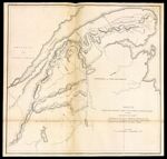
Name: Sketch from Bouchette's maps of upper & lower Canada and the district of Gaspe Exhibiting the true range of highlands dividing the waters of the St. Lawrence & the Atlantic, and the imaginary ranges claimed by the British for the boundary of the State of Maine.
Barcode:
Image Number:
Creator:
Date Created:
Date Published:
Alternative Title: Plate II.
Notes: 1829 - Copyright
Permanent URL: