

Collection: Smith Collection
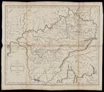
Name: Map of the state of Kentucky : with the adjoining territories
Barcode:
Image Number:
Creator:
Date/Date Range Produced:
Date/Date Range Published:
Dimensions: 38 x 45
Notes: Note at bottom: "London. Published as the Act directs Nov. 29 1794 by H.D. Symonds No. 20 Paternoster Row." Detached from "Maps belonging to W. Winterbotham's History of America" (1804)
Physical Description: 1 map ; 38 x 45 cm
LC Call Number: G3950 1794 .R8
OCLC: 32537050
Accession Number: SM-1794-23
Donor:
Permanent URL: