

Collection: Smith Collection
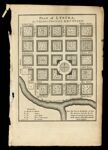
Name: Plan of Lystra, in Nelson County, Kentucky
Barcode:
Image Number:
Creator:
Date/Date Range Produced:
Date/Date Range Published:
Language:
Dimensions: 16 x 12
Notes: Detached from "Maps belonging to W. Winterbotham's History of America" (1804)
Accession Number: SM-1804-18
Donor:
Permanent URL: