

Collection: Osher Map Library Collection
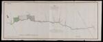
Name: Plan of all the lands granted under the authority of New Brunswick on the northerly side of the River St. John and westward of the commissioners line signed Thos. Baillie, S. General.
Barcode:
Image Number:
Creator:
Publishing Location:
Date/Date Range Produced:
Date/Date Range Published:
Language:
Dimensions: 32 x 81
Physical Description: Printed signature: "A. Wells Comm." Top left corner of map: "Map D."
LC Call Number: G3431.F2 1845 B3
OCLC: 948202802
Accession Number: OML-1845-44
Permanent URL: