

Collection: Hamilton-Thayer Collection
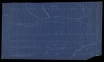
Name: Plan of township no.2, R-1 or, Sandwich Town
Barcode:
Image Number:
Surveyor:
Publishing Location:
Date/Date Range Produced: 1898
Language:
Map Type:
Dimensions: 36 x 61 cm
Brief Description: Indicates public lots located in 1846. Shows Misery Dam, Misery Gore, Canadian Pacific Railroad part of Sandwich Academy land grant. After the Revolutionary War, Massachusetts sold off large tracts of land to pay off war debt. Some of the land sales benefited educational institutions such as Sandwich Academy.
LC Call Number: G3732.M59 1898 O3
OCLC: 1107880224
Accession Number: HT-1898-101
Donor:
Permanent URL: