

Collection: Osher Map Library Collection
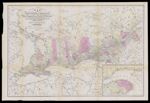
Name: Map of the province of Canada from Lake Superior to the Gulf of St. Lawrence corrected from information obtained by the geological survey under the direction of Sir W.E. Logan and prepared for the Canada directory Thos. C. Keefer C.E. Montreal
Barcode:
Image Number:
Creator:
Publisher:
Publishing Location:
Date/Date Range Produced: 1857
Language:
Region Depicted:
Map Type:
Dimensions: 57 x 85 on sheet 62 x 91 cm
Brief Description: Detailed map of Canada showing counties and township divisions. Completed railroads, railroads in progress, and projected are noted.
LC Call Number: G3400 1857 B2
OCLC: 80340292
Accession Number: OML-1857-61
Permanent URL: