

Collection: Textile Museum Collection
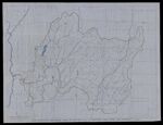
Name: Map showing drainage area of Batten Kill in eastern New York and Vermont above big falls
Barcode:
Image Number:
Date/Date Range Produced: 1960
Language:
Region Depicted:
Map Type:
Dimensions: 1 map; 75 x 96 cm
Brief Description: Depicts rivers, lakes, creeks, throughout eastern New York and Vermont as well as towns and railroads.
LC Call Number: G3802 1960
OCLC: 1124925046
Accession Number: ATH-1960-216
Permanent URL: