

Collection: Osher Map Library Collection
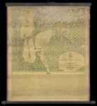
Name: A Map of the ancient Indian towns on the Pickaway Plain illustrating a sketch of the country by Felix Renick
Barcode:
Image Number:
Creator:
From Atlas:
Publishing Location:
Surveyor:
Date/Date Range Produced: 1846
Language:
Region Depicted:
Map Type:
Dimensions: 46 x 51 cm on sheet 68 x 57 cm
Brief Description: Map depicts the conflict known as Lord Dunmore's War which involved colonial Virginia and the Shawnee and Mingo Indian Nations. Included is Felix Renick's text on what he viewed as a great injustice against the Indians by colonial forces in 1774 in Ohio.
LC Call Number: G4083 1846.P5
OCLC: 858556728
Accession Number: OML-1846-68
Subjects:
Permanent URL: