Sort By:
![Falmouth Harbor Portland Sound [facsimile]](https://odyssey.historyit.com/img/thumbnail/Map.png?no_errors=1)
Creator
Publisher
Surveyor
Language
Region Depicted
Map Type
DimensionsChart: 74.5 x 53.5 cm on sheet: 79.5 x 59 cm
Printing Process
Material Type
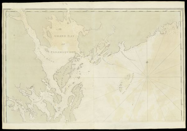
Historical ContextChart of Casco Bay, originally published in London at the beginning of the Revolution, provides the first detailed view of the Portland peninsula, then called Falmouth Neck.
LC Call NumberG3732.P6 D4 1776
OCLC229892607
Accession NumberSM-1776-16
See Also
Donor
Subjects
Creator
Publisher
Surveyor
Language
Region Depicted
Map Type
DimensionsChart: 74.5 x 53.5 cm on sheet: 79.5 x 59 cm
Printing Process
Material Type
Historical ContextChart of Casco Bay, originally published in London at the beginning of the Revolution, provides the first detailed view of the Portland peninsula, then called Falmouth Neck.
LC Call NumberG3732.P6 D4 1776
OCLC229892607
Accession NumberSM-1776-16
See Also
Donor
Subjects
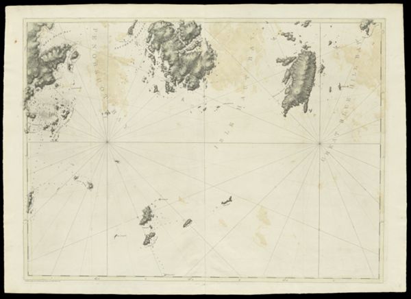
![[Coast of Maine - Two Views of Wolves Islands at Entrance of Passamaquoddy Bay]](https://cdn1.historyit.com/iiif/2/5f34291499c4a6.60628694/660c05f5428561.90663406.jpg/full/!600,600/0/default.jpg?no_errors=1)
Creator
Publisher
Surveyor
Language
Region Depicted
Map Type
DimensionsChart: 74.5 x 53.5 cm on sheet: 79.5 x 59 cm
Printing Process
Material Type
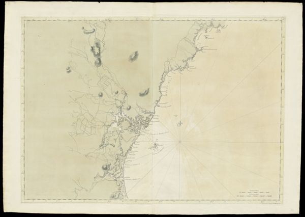
Historical ContextChart of Casco Bay, originally published in London at the beginning of the Revolution, provides the first detailed view of the Portland peninsula, then called Falmouth Neck.
LC Call NumberG3732.P6 D4 1776
OCLC229892607
Accession NumberSM-1776-16
See Also
Donor
Subjects
Creator
Publisher
Surveyor
Language
Region Depicted
Map Type
DimensionsChart: 74.5 x 53.5 cm on sheet: 79.5 x 59 cm
Printing Process
Material Type
Historical ContextChart of Casco Bay, originally published in London at the beginning of the Revolution, provides the first detailed view of the Portland peninsula, then called Falmouth Neck.
LC Call NumberG3732.P6 D4 1776
OCLC229892607
Accession NumberSM-1776-16
See Also
Donor
Subjects