EXHIBIT NAVIGATION
During the early 19th century, the United States government began a massive effort to move eastern tribes west. The American population increased by over 1.5 million between 1810 and 1830, and it became clear that the western Native American tribes would pose problems to further growth. Thus, the Indian Removal Act was passed by Congress in 1830, under President Andrew Jackson. The act had strong support, particularly in the South, where the land was inhabited by the Five Civilized Tribes (named because they seemed more willing to accept Christianity and cultural assimilation). Native American chiefs received incredible pressure to sign removal treaties, which undoubtedly caused conflicts within tribes and tribal confederations. During the Trail of Tears, tens of thousands were forcibly removed from their homes, and roughly 1 out of every 4 died from disease or starvation. The maps in this section show how these events transformed American geography.
Map of the United States with the contiguous British & Spanish Possessions Compiled from the latest & best Authorities By John Melish Engraved by J. Vallance & H. S. Tanner. Entered according to Act of Congress the 6th day of June 1816. Published by John

John Melish, John Vallance, and Henry Schenck Tanner, Hand-colored Copper Engraving, London, 1816
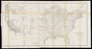
Map of the United States and Territories. Shewing the extent of Public Surveys and other details constructed from the Plats and official sources of the General Land Office under the direction of the Hon. Jos. Wilson Commissioner. By Theodore Franks Draugh

H 78 x W 146 cm
By comparing this with the previous map, we can see how severely the Indian Removal Act affected Native migration patterns. In 1816, there were still signs of Cherokee settlements in present-day Georgia, as well as the Choctaw in Mississippi. By 1866, they were successfully removed to Indian Territory.
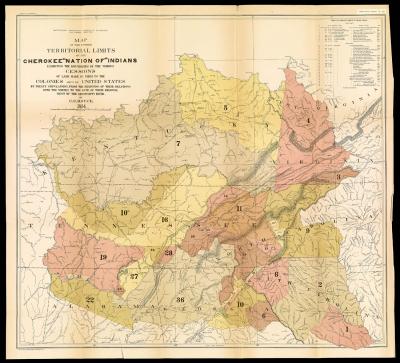
Map of the Former Territorial Limits of the Cherokee “Nation of” Indians exhibiting the boundaries of the various Cessions of Land made by them to the Colonies and to the United States by treaty stipulations, from the beginning of their relations with the whites to the date of their removal west of the Mississippi River. by C. C. Royce, 1884

Charles C. Royce, Washington D.C., 1884
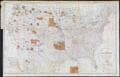
Map Showing the Location of the Indian Reservations within the Limits of the United States and Territories.

United States Office of Indian Affairs, Washington D.C., 1888
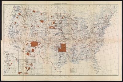
Map showing Indian Reservations in the United States, 1916

Department of the Interior, Leipzig, 1916
