

Collection: Osher Map Library Collection
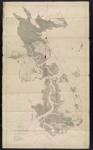
Name: West Portion of Jamaica Bay, New York Topographic Survey under the direction of the Jamaica Bay Improvement Commission Sept. to Dec. 1909
Barcode:
Image Number:
Publishing Location:
Notes: Pencil and red ink notations on map. Originally signed by three commissioners: Philip J. Farley, William G. Ford and John J. McLaughlin.
Date/Date Range Produced:
Date/Date Range Published:
Language:
Dimensions: 73 x 42
Physical Description: 1 map: illustrated
LC Call Number: VK.587.J3.1909
OCLC: 70191336
Accession Number: OML-1909-30
Permanent URL: