Sort By:
Creator
Atlas Reference
Date/Date Range Produced1598 - 1619
Language
Region Depicted
Map Type
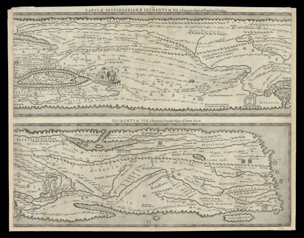
DimensionsH 41.9 x W 53 cm
Printing Process
Material Type
Historical ContextKnown as the Peutinger Tables, these eight maps are copied from a series of manuscripts showing the Roman road network in the third or fourth century. They are early examples of data visualization showing all distances between places but not to scale or direction. As such, they are more like a cartogram than a map.The Peutinger Table is a series of ?road maps? showing the network of routes from ancient Rome to the far corners of the known world. Distorted landmasses emphasize the east-west flow of the routes, and icons of buildings mark important points along the way; this is more about itinerary than literal representation of place.
Accession NumberOS-1619-2.3
See Also
Donor