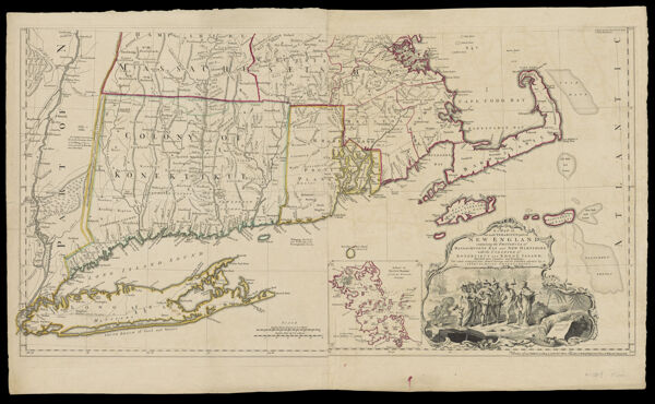
Map of the Most Inhabited Part of New England, containing the Provinces of Massachusetts Bay and New Hampshire, with the Colonies of Konektikut and Rhode Island, Divided into Counties and Townships: The whole composed from Actual Surveys and its Situation adjusted by Astronomical Observations.CreatorGreen, John, active 1730-1753Jefferys, Thomas, 1710-1771
Date/Date Range Produced1755
LanguageEnglish
Dimensions53 cm. x 98 cm. on sheet 69 cm. x 102 cm.
Printing ProcessEngraving
Material TypePaper
OCLC5416640
Accession NumberOS-1755-13.1
See AlsoMap of the Most Inhabited Part of New England, containing the Provinces of Massachusetts Bay and New Hampshire, with the Colonies of Konektikut and Rhode Island, Divided into Counties and Townships: The whole composed from Actual Surveys and its Situation adjusted by Astronomical Observations.
DonorOsher