

The militaries of the Great War relied on maps for many purposes, including planning offensive maneuvers, training officers, and organizing effective fortifications. Invaluable to these efforts were maps of enemy trenches and defensive lines, the situations of which were discovered through aerial photography and other methods of observation.
The advancement in accurate mapmaking during the first year of World War I, marked by the adoption of the Lambert projection by the French military, enabled its most deadly technique, predictive fire. Originally called “map shooting,” this technique allowed infantrymen to follow behind a line of heavy artillery fire that, theoretically, would damage the defenses of the opposing army.
This map shows the rolling barrage lines of the American 4th Division, who were protecting the eastern flank of the inexperienced 79th Division at Montfaucon, a major target in the Meuse-Argonne Campaign. The ultimate objective of the campaign was to capture the Sedan railroad hub, severing the rail net that supported the German Army in occupied areas of France and Flanders. Located on a hill, the village of Montfaucon was extremely well fortified with trenches, entanglements, gun positions, and pillboxes to cover all possible approaches.
The objective of the 79th Division was to capture three cities in their assigned sector: Malancourt, already in ruins and a town in name only; Montfaucon, which the Germans boasted to be untakeable, nicknaming it "Little Gibraltar"; and Nantillois, a town 9 km past the German army's defensive line. The "No Man's Land" of the area was littered with canalizing wire obstacles and maze-like trench systems, some of which had long been abandoned and others that were still occupied. The terrain itself, having been torn apart by shelling earlier in the war, was extremely difficult and contained numerous steep hills and ravines, many of which were entirely covered by barbed wire entanglements. A U.S. military battle analysis would later report, "Millions of artillery shells had altered the terrain to such an extent that it was virtually impossible to move a couple of steps without falling into a three to four foot deep crater."
Without a doubt, the pockmarked ground the 79th Division was expected to traverse was the most difficult terrain in the entire Meuse-Argonne campaign, and, furthermore, the German positions in the Avocourt-Montfaucon sector were the most formidable of the entire Western Front. And yet, this sector, the most treacherous and important of the early campaign was bafflingly assigned to the inexperienced 79th Division. The majority of the fighting men of the 79th were draftees who'd served for less than four months and had relatively little training. Additionally, the division had never seen combat. Thus, it can be no surprise that the 79th failed to capture Montfaucon of the first day of the offensive as planned, holding up the advance of the entire Allied Expeditionary Force.
Upon reaching Golfe de Malancourt, the 79th's two infantry brigades, the 157th and 158th, encountered strong defenses and heavy fire from the 117th German Infantry Division. The amount of time it would take for the men of the 79th to trek across the terrain from Malancourt to Montfaucon was severely underestimated, creating problems with their rolling barrage outpacing them. Unfortunately, there was no way to quickly communicate with the artillery brigade behind them as the division had been given poorly insulated telephone wire that went out upon getting wet, causing them to lose both lateral and rear communication. Messengers were quickly picked off by German snipers, and it would take hours for messages to be delivered within the division. They also lost contact with the 4th Division, flanking them to the right.
After taking Montfaucon well behind schedule, the 79th suffered from a severe lack of supplies; the terrain was so rough that only 100 burros had been able to make it to the front line, carrying not nearly enough food for the thousands of men. Hungry and tired, two regiments of the 79th Division, the 315th and 316th, nevertheless managed to take Nantillois three days later than originally planned. By then, the 315th had lost half of its men to death or injury, and approximately 800 men in the 79th Division had been gassed in their efforts to complete their mission. Despite their poor condition, the troops held the city until they could be relieved by the 3rd Division on October 3.
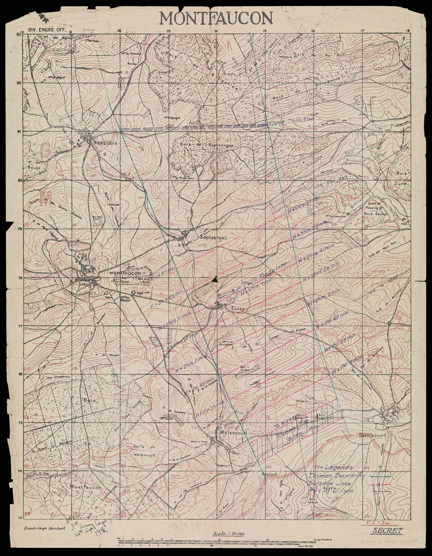
map/47994
23. Montfaucon
U.S. Army Corps of Engineers, 1918
Kelsey Collection
URL: www.oshermaps.org/map/47994
One difficulty faced by the American Expeditionary Force [AEF] upon their arrival on the Western front was the lack of adequate maps of the area. Many of the key locations in the war had not been surveyed in several years or decades. Thus, the cartographic knowledge available to the AEF was often outdated or inadequately scaled. The scale of this particular map is only 1:200,000; the preferred scale for battle maps was 1:10,000 or 1:20,000.
The AEF relied on the French military to provide maps of the necessary regions, which would then be reproduced by the AEF's Topographic Division, the 29th Engineers, at their Base Printing Plant at Langres, Haute Marne; the reproduced maps would be distributed to the appropriate military officers as fast as possible.
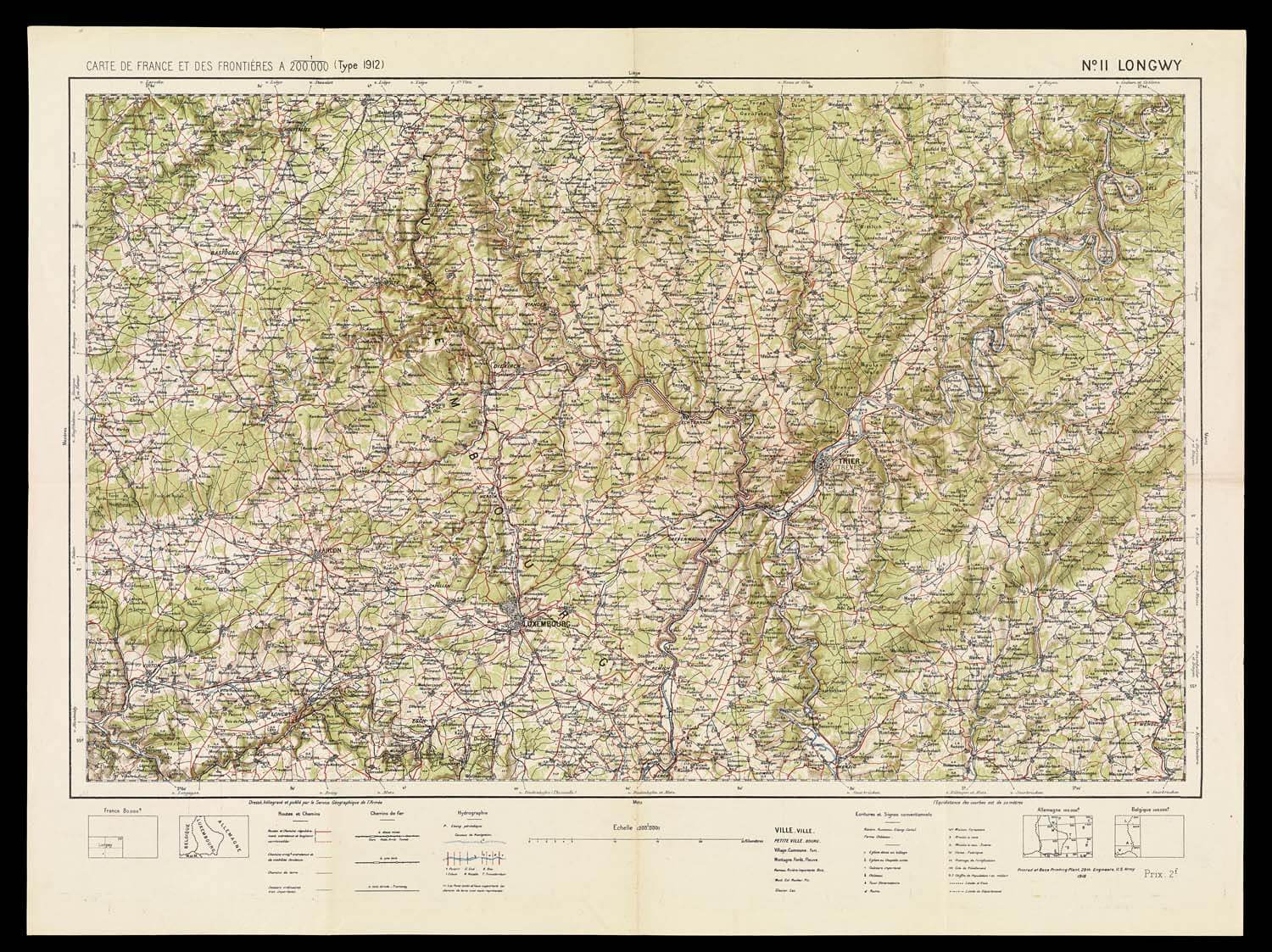
map/12885
24. Carte de France et des Frontieres
Service Geographique de l'Armee, 1918
Rice Collection
URL: www.oshermaps.org/map/12885
Despite the lack of adequate maps at the beginning of the American entry into the war, updated maps could be created with the aid of aerial photography, providing the military with much-needed geographic information. New enemy trenches and fortifications could be located and accurately mapped with aerial photographs. Reconnaissance flying, while critical for military defense and operations, was extremely dangerous; during the worst months of the war for the Royal Flying Corp, the average time a British pilot could expect to survive was only 69 flying hours.
This photograph was taken above Triers, formerly called Treves by the Allies, a city that can also be found in the bottom left section of the previous map (#24). Triers played a role during World War I as a Zeppelin air base for the Germans and, after the Armistice, as the Advance General Headquarters for the American Expeditionary Forces.
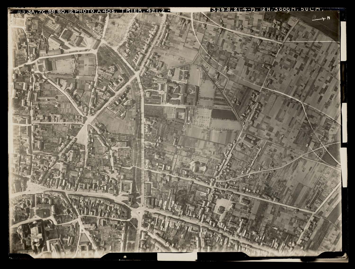
map/50195
25. [Aerial photograph of Triers]
[Unknown Photographer], 1919
Kelsey Collection
URL: www.oshermaps.org/map/50195
This British map is a good example of a map updated with information gathered through aerial photography. Like all maps intended for use near the front lines, only the enemy trenches are shown; it was deemed too risky to map one's own trenches in case the document were to fall into the enemy's hands. The red lines on the map are the enemy trenches that had been added or altered as of January 5, 1918. As noted in the top left corner, a few of the trenches shown on the map were discovered through means other than aerial photography and are marked differently than the others.
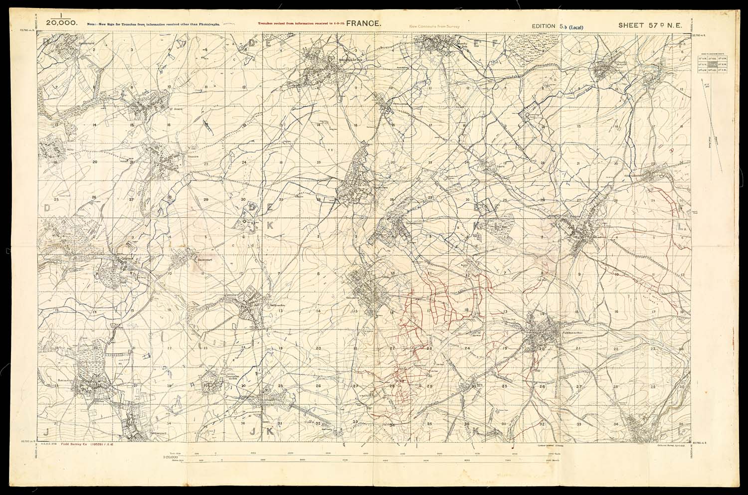
map/46371
26. France
Great Britain War Office, 1918
Story Collection
URL: www.oshermaps.org/map/46371
Another French map reproduced by the American 29th Engineers, this map of Vigneulles and the surrounding area includes updated information about the enemy's trenches, likely gathered from aerial photographs taken on May 17, 1918; the note at bottom right translates to "advanced line of trenches on date of 17 May, 1918." This area would see conflict throughout the Meuse-Argonne offensive. On the very first day of the campaign, Riaville and Marcheville (center-left) were attacked by the 26th "Yankee" Division as a diversion to call attention away from the real objective, Montfaucon and Nantillois, a little over fifty kilometers to the northwest. On the last day of the campaign, Ville-en-Woëvre (top-center) was captured by the American 81st Division only hours before receiving news of the Armistice.
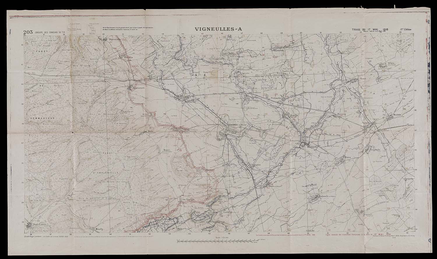
map/43193
27. Vigneulles
Groupe de Canevas de Tir, 1918
Rice Collection
URL: www.oshermaps.org/map/43193
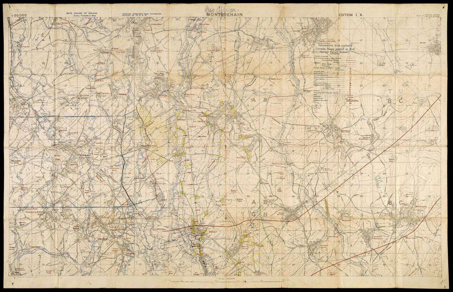
This map of the area west of the Hindenburg Line includes numerous intriguing annotations. The printed information dates to September 19, 1918, the day after the town of Epehy (top-left of the map) was captured by the British 12th Eastern Division. The towns of Bellicourt and Montbrehain lie between the two red printed divisional lines, which suggests that the lines delineate the sector of either the Australian 2nd, 3rd, or 5th Division. However, the addition of two hand-drawn parallel blue lines on the map's left edge, almost certainly representing another divisional sector, suggest that the officer who used it belonged to a different division.
The map's annotations are intriguing, but their meanings are difficult to determine. It's likely that the red hand-drawn line stretching between the blue hand-drawn divisional boundaries is the position of the annotator's division immediately prior to the September 29th capture of Bellicourt by the Australian 3rd and 5th Divisions and American 27th and 30th Divisions. The hand-drawn black line to the left runs along a road that could have been a supply route. Perhaps the most mysterious of the annotations, the yellow circles that appear between the towns of Bellicourt and Le Catelet may indicate places where gas had been used. Although there is no indication that Australian forces used gas during their captures of Bellicourt and Montbrehain, it is possible that fleeing German troops released gas in trenches and dugouts as obstacles for the advancing Allied forces. However, this is mere speculation based on the handwritten label, "Gas Officer," above the map's title.
The land depicted was a key area in the Allied endeavor to breach the German's Hindenburg Line, which consisted of four major trench systems, including the Beaurevoir Line, their final prepared line of defense; when the Beaurevoir Line was taken, the Germans were forced to retreat into unfortified territory. The Australian Imperial Forces (AIF) were instrumental in the success of the effort. One of the major components of the plan was the capture and occupation of the village of Montbrehain, advantageously located on a hill that overlooked land to the east, making it key in preventing the Germans from retaking their lines. The Australian 2nd Division achieved this difficult capture on October 5th.
map/15085
28. Montbrehain
British Expeditionary Force, 1918
Story Collection
URL: www.oshermaps.org/map/15085
Upon entering the war in 1917, the American Expeditionary Forces were largely reliant on the French military for maps of the front lines and surrounding areas. Since few American officers read French, a list of frequently used geographic terms translated from French to English was necessary for accurate map reading; in fact, the last section of this booklet is comprised of eleven pages of relevant French words and abbreviations with their English equivalents. Similarly, the symbols used on European maps were not always consistent with those traditionally used in American cartography. Some of the maps provided by the French marked military bases and artillery objectives, the symbols for which are identified in this booklet. In order to keep the German army from accessing this potentially compromising information, officers were not allowed to take this book into the front line trenches.

map/13066
29. List of Conventional Signs and Abbreviations in use on French and German Maps
American Expeditionary Forces General Headquarters, 1917
Kelsey Collection
URL: www.oshermaps.org/map/13066
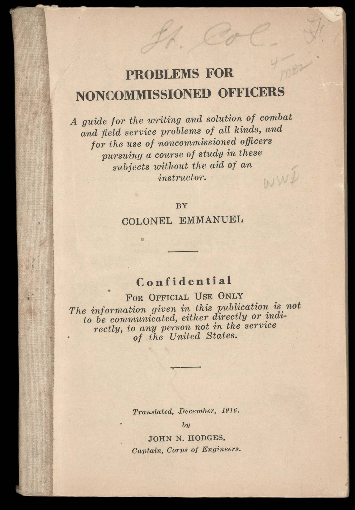
While Problems for Noncommissioned Officers was printed by the U.S. Army Service Schools Press at Fort Leavenworth, the original author, the prolific military theoretician Friedrich Immanuel, was a colonel in the German Army. One of his books on tactics was discovered at the Army War College in Washington D.C. by Captain J. C. Gotwals, who recognized its potential value for students of military strategy. His colleague, Captain John Hodges, translated the book into English and altered the content slightly to better conform with the practices and organization of the U.S. Army.
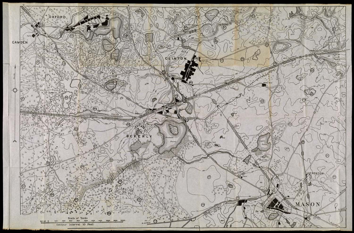
The book contains fifty tactically complex scenarios to which the student is asked to find solutions by using the accompanying map, which provides details about the terrain referred to in the scenarios. Possible solutions for each problem, some illustrated by diagrams, are included. Like the text of the book, the map is Anglicized, its landmark names changed to sound more familiar to the American student, and its distances converted to U.S. measures.
map/43687
30. Problems for Noncommissioned Officers
Friedrich Immanuel, 1916
OML Collection
URL: www.oshermaps.org/map/43687
map/43688
31. [Terrain map for use with "Problems for Noncommissioned Officers"]
Friedrich Immanuel, 1916
OML Collection
URL: www.oshermaps.org/map/43688
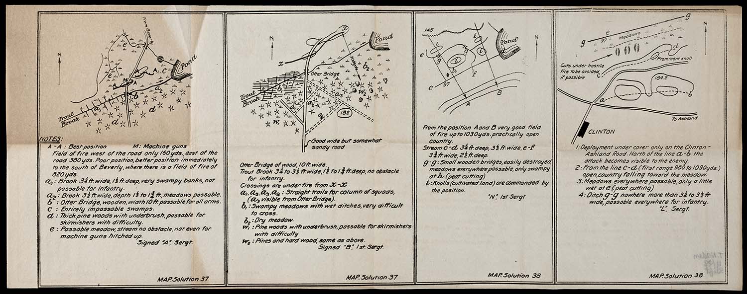
map/43689
32. [Solutions 37 and 38, for use with "Problems for Noncommissioned Officers"]
Friedrich Immanuel, 1916
OML Collection
URL: www.oshermaps.org/map/43689
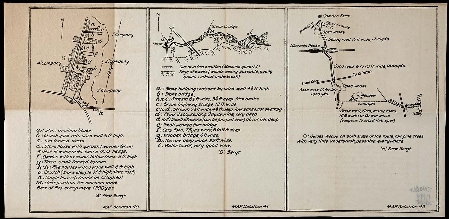
map/43690
33. [Solutions 40, 41, and 42, for use with "Problems for Noncommissioned Officers"]
Friedrich Immanuel, 1916
OML Collection
URL: www.oshermaps.org/map/43690
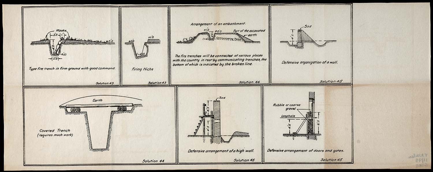
map/43691
34. [Solutions 43, 44, and 45, for use with "Problems for Noncommissioned Officers"]
Friedrich Immanuel, 1916
OML Collection
URL: www.oshermaps.org/map/43691
Prepared at the General Headquarters of the U.S. Army shortly after the war, this map shows the locations of both the Allied and German divisions along the Western Front when the Armistice of Compiègne went into effect at 11:00 AM on November 11, 1918, "the eleventh hour of the eleventh day of the eleventh month." On either side of the front line, which stretches from Belgium to the Alps, are shorter lines representing the boundaries between the corps.
The negotiation process for the Armistice began on November 8 with the arrival of the German delegation in the forest of Compiègne, where they were taken to a private train car belonging to the French General, Ferdinand Foch. Although they were given 72 hours to consider the Allied demands, the Germans had little room for negotiation and were compelled to agree to complete demilitarization and payment of war reparations. The signing took place around 5:15am on November 11, less than six hours before it would go into effect.
While some units greeted news of the Armistice with cheering and applause, others continued to fight until the last minute. Motivations ranged from desire for revenge or last-minute glory to more practical concerns, like exhausting supplies of heavy ammunition to avoid the responsibility of removing them. Sadly, in the hours between the announcement of the ceasefire and its official commencement, more than 10,000 men were needlessly killed or wounded, a higher casualty rate than experienced on D-Day in World War II.
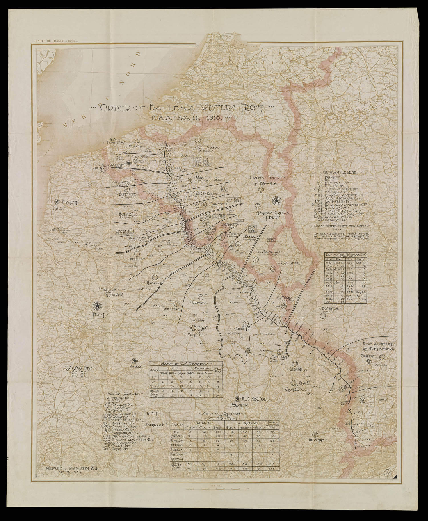
map/48334
35. Order of Battle on the Western Front
U.S. Third Army Advance General Headquarters, 1918
OML Collection
URL: www.oshermaps.org/map/48334
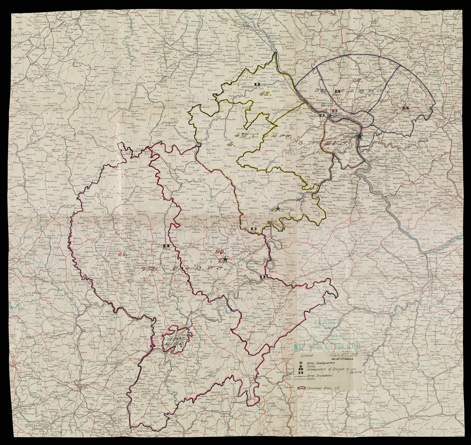
American troops remained in Germany after the Armistice for a little over four years, occupying a northern section of the Rhineland—the American Occupation Zone—that included the cities Coblenz and Trier, which English-speakers typically called Treves. Belgium, Britain, and France similarly maintained occupation zones. The American occupying force, named the Third Army, totaled about 250,000 men; each of its nine divisions was responsible for one section of the Zone. Coblenz, the largest city of the Zone with 65,000 citizens, was chosen as the site of the Headquarters for the Third Army, but it was inconveniently situated far from the divisional areas of the 89th and 90th. An "Advance General Headquarters" was therefore established at the occupation Zone's second largest city with 45,000 people, Trier, located in the southernmost section.
The Third Army met with several challenges early on, including a shortage of living quarters for all its men. Approximately one million Germans lived in the American occupation zone, and only some resided in villages or towns. Ninety percent of American soldiers were billeted with citizens during the first months of the occupation, effectively doubling the urban populations overnight and creating water supply and sanitation concerns. By summer of 1919, the army had been reduced to just 8,400 men and was disbanded. The remaining force was reorganized and named the American Forces in Germany, which existed until the last American troops were withdrawn in January of 1923.
map/48336
36. American Occupation Zone in Germany
U.S. Third Army Advance General Headquarters, 1919
OML Collection
URL: www.oshermaps.org/map/48336