Showing 97151-97160 of 114609 results

Sort By:

Bookform edition of the official map of Maine
Publisher:
Date Produced: 1934
Language:
Physical Description: 1 atlas 31, [17] pages : chiefly color maps; 23 cm
LC Call Number: G1215 .N3 1934 c.2
OCLC: 47811091
Accession Number: FRE-1934-93
Donor:
Image Number:


Deutscher Schulatlas
Author:
Date Produced: 1943
Physical Description: 34 pages : illustrations, including color maps (some folded) color diagram ; 32 cm
LC Call Number: G1019 .D48 1943
OCLC: 17338199
Accession Number: MOR-1943-98
Donor:
Donation Date: Mar 31st, 2016
Image Number:


American Atlas
American Atlas
Author:
Date Produced: 1753 - 1775
Language:
Dimensions: 53 cm. x 116 cm.
Physical Description: Thomas Jefferys died in 1771. His successors Robert Sayer and John Bennett gathered a compilation of separately-published maps and republished them in book form as the American Atlas in 1775. Among the maps are a map of Russian discoveries, map of the British empire in North America, Jefferys's Bay of Honduras, a chart of the Straits of Magellan by Don Juan de la Cruz Cano y Olmedilla and charts of North and South America.
LC Call Number: G1100 .J4 1775
OCLC: 927113830
Accession Number: OS-1775-24
Donor:
Image Number:


Carte de la France, Tome I
Author:
Language:
Dimensions: Cover: 65 x 53.5 cm, maps: 64 x 97.5 cm
Physical Description: Three volume set of the Carte de la France includes in volume one the 1744 outline map by Jean Dominique Maraldi and Cassini de Thury. The Carte was completed in 1789. It was the first general topographic map of the whole country based on triangulation and topographic surveys. Cesar -Francois Cassini I began the project but he died in 1784. It fell to his son Jean Dominique Cassini IV to complete the survey/triangulation until ownership and control was assumed by the revolutionary government in 1793.
LC Call Number: G5831 .B3 1789 .M3
OCLC: 930610800
Accession Number: OS-1789-2.1
Donor:
Image Number:


Plan de Paris
Plan de Paris
Author:
Date Produced: 1739
Language:
LC Call Number: G5834 .T8 1739
Accession Number: OS-1739-2
Donor:
Image Number:


The World's Greatest War
Author:
Date Produced: 1917
Language:
Dimensions: 87 x 107 cm.
Physical Description: cover is in very poor condition, and pages are held together by string
Accession Number: EGS-1917-90
Donor:
Image Number:


I. pars Romanae Urbis Topographiae & Antiquitatum, Quâ succinctê & breviter describuntur omnia quæ tam publicê quam privatim bidenture anim-adversione digna: Iano Iacobo Boissardo Vesuntio autore Tabula chorographica totius Italiæ Figurae aliquot elegante
Author:
Date Produced: 1597
Language:
Dimensions: 31 cm.
Physical Description: 3 parts in 1 volume; plates: illustrated maps, portraits
LC Call Number: DG625 B68 1597
OCLC: 18508434
Accession Number: SM-1597-1
Donor:
Image Number:


The Description and Use of the Terrestrial Globe.
Author:
Date Produced: 1671
Language:
Dimensions: 19 cm.
LC Call Number: GA265.G74 1671
OCLC: 37333577
Accession Number: SM-1671-3
Donor:
Subjects:
Image Number:


A new discovery of a vast country in America, extending above four thousand miles, between New France and New Mexico  with a description of the Great Lakes, cataracts, rivers, plants, and animals  also, the manners, customs, and languages of the several native Indians, and the advantage of commerce with those different nations  with a continuation, giving an account of the attempts of the Sieur de la Salle upon the mines of St. Barbe, &c. : the taking of Quebec by the English, with the advantages of a shorter cut to China and Japan : both parts illustrated with maps and figures, and dedicated to His Majesty K. William by L. Hennepin to which is added, several new discoveries in North-America, not publish'd in the French edition
A new discovery of a vast country in America, extending above four thousand miles, between New France and New Mexico with a description of the Great Lakes, cataracts, rivers, plants, and animals also, the manners, customs, and languages of the several native Indians, and the advantage of commerce with those different nations with a continuation, giving an account of the attempts of the Sieur de la Salle upon the mines of St. Barbe, &c. : the taking of Quebec by the English, with the advantages of a shorter cut to China and Japan : both parts illustrated with maps and figures, and dedicated to His Majesty K. William by L. Hennepin to which is added, several new discoveries in North-America, not publish'd in the French edition
Alternative Title: New discovery of a large country in America
Author:
Date Produced: 1698
Language:
Dimensions: Height: 20
Physical Description: 8 volumes: maps, illustrated
LC Call Number: F352.H753 1698
OCLC: 17430373
Accession Number: SM-1698-2
Donor:
Image Number:


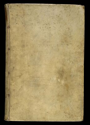
Atlas Minor Sive Totius Orbis Terrarum Contracta Delineatio
Author:
Date Produced: 1703
Language:
Dimensions: Height: 50
Physical Description: Composite atlas featuring maps by the Danckerts firm, Gerard Valck, Homann Heirs, Nicolas Sanson, Nicholas Visscher.
LC Call Number: G1015 .D3 1703
OCLC: 933759937
Accession Number: SM-1703-12
Donor:
Image Number: