
I was just grazing some of OML's online images, and for some reason decided to look at a map of Palestine, based on the original work ofTilemann Stella, from a later edition of Ortelius's Theatrum orbis terrarum (OML-1597-7). Among other things,...
We are very pleased to announce that an online version OML's 2012-2013 exhibition, Iconic America: The United States Map as a National Symbol; Highlights from the Fondersmith Collection of Cartographic Ephemera, is now installed on the OML website:Th...
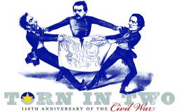
April 2, 2013 to August 24, 2013 ... OML is pleased to present, as part of the 2013 Maine Civil War Trail, a subset of the exhibition of the same name, curated by Dr. Ronald E. Grim and originally installed in 2011 at the Norman B. Leventhal Map Ce...
[expand title="EXHIBIT NAVIGATION"] Iconic America Ushapia Creating the Iconic Map Art Maps Wearing Ushapia Campaign Memorabilia Political Cartoons Books and Magazine Covers Decorative Ushapia Household Ushapia Games and Puzzles Maine M...
[expand title="EXHIBIT NAVIGATION"] Iconic America Ushapia Creating the Iconic Map Art Maps Wearing Ushapia Campaign Memorabilia Political Cartoons Books and Magazine Covers Decorative Ushapia Household Ushapia Games and Puzzles Maine M...
[expand title="EXHIBIT NAVIGATION"] Iconic America Ushapia Creating the Iconic Map Art Maps Wearing Ushapia Campaign Memorabilia Political Cartoons Books and Magazine Covers Decorative Ushapia Household Ushapia Games and Puzzles Maine M...
[expand title="EXHIBIT NAVIGATION"] Iconic America Ushapia Creating the Iconic Map Art Maps Wearing Ushapia Campaign Memorabilia Political Cartoons Books and Magazine Covers Decorative Ushapia Household Ushapia Games and Puzzles Maine M...
[expand title="EXHIBIT NAVIGATION"] Iconic America Ushapia Creating the Iconic Map Art Maps Wearing Ushapia Campaign Memorabilia Political Cartoons Books and Magazine Covers Decorative Ushapia Household Ushapia Games and Puzzles Maine M...
[expand title="EXHIBIT NAVIGATION"] Iconic America Ushapia Creating the Iconic Map Art Maps Wearing Ushapia Campaign Memorabilia Political Cartoons Books and Magazine Covers Decorative Ushapia Household Ushapia Games and Puzzles Maine M...
[expand title="EXHIBIT NAVIGATION"] Iconic America Ushapia Creating the Iconic Map Art Maps Wearing Ushapia Campaign Memorabilia Political Cartoons Books and Magazine Covers Decorative Ushapia Household Ushapia Games and Puzzles Maine M...