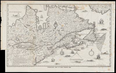
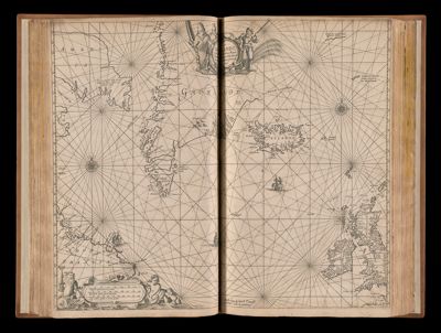
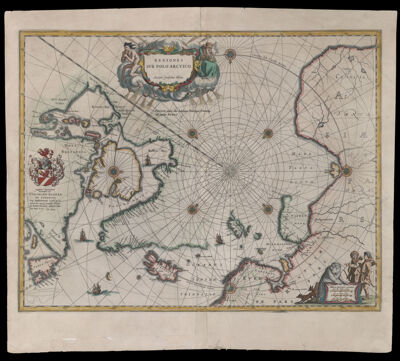
Regiones Svb Polo Arctico. Auctore Guiljelmo Blaeu.
Creator: Blaeu, Willem Janszoon, 1571-1638Publisher: Blaeu, Willem Janszoon, 1571-1638Date/Date Range Produced: 1645
Language: LatinRegion Depicted: AlaskaArctic OceanArctic regionsCanadaDenmarkFinlandGreenlandIcelandNewfoundland and LabradorNorth PoleNorthwest PassageNorthwest TerritoriesNorwayNunavut, CanadaRussiaScandinaviaSwedenYukon TerritoryMap Type: GeographicalNautical chartsDimensions: 42 x 53 cm.
Printing Process: EngravingMaterial Type: PaperHistorical Context: Considered a prototype of maps of the Arctic, this map incorporates new information from the explorations of Barentsz, Baffin, Frobisher, Hall, Davis, and Captain Thomas James, whose discovery of a bay is marked with the label, "James his Bay." The Arctic coast of Russia features information from Willem Barentsz' voyage, and Spitsbergen is shown according to surveys by the Danish expedition of James Hall. Rhumb lines radiate from the North Pole, and a large title cartouche featuring two figures and numerous wind heads conveniently hides the northwest coast of America; this map?s depiction of Greenland as connected to the main North American landmass would have been controversial, because it disavows the possibility of the famous "Northwest Passage." However, the map does suggest the existence of a Northeast Passage by showing the Siberian coastline intact and the sea clear of any barriers.
LC Call Number: G3270 1645 .B5
OCLC: 57436957
Accession Number: OS-1645-1
Donor: OsherSubjects: AlaskaAnimalsAnthropomorphismArctic OceanArctic regionsBearsBlaeu, Willem Janszoon, 1571-1638CanadaClothing and dressDenmarkDevices (Heraldry)EthnologyExploration and discoveryFinlandFoxesGreenlandHeraldryHuntersIcelandIndigenous peopleMaps--Early works to 1800Nautical chartsNewfoundland and LabradorNorth PoleNorthwest PassageNorthwest TerritoriesNorwayNunavutPolar bearRussiaSailing shipsScandinaviaSwedenSymbolismWindsYukonImage Number: 428.0001; 428.0002