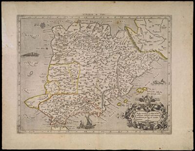
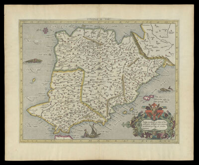
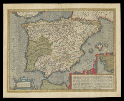
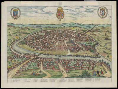
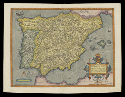
Regni Hispaniae Post Omnivm Editiones Locvpleissima Descriptio.
Creator: Ortelius, Abraham, 1527-1598Atlas Reference: Theatrum orbis terrarumPublisher: Ortelius, Abraham, 1527-1598Date/Date Range Produced: 1592
Language: LatinRegion Depicted: Balearic IslandsIberian PeninsulaPortugalSpainMap Type: GeographicalPolitical mapsDimensions: H 42.7 X W 56.2 cm
Printing Process: EngravingMaterial Type: PaperHistorical Context: An innovative mechanism established for disseminating maps was the systematic atlas. The first edition of each atlas featured Latin text, but subsequent editions were issued in all the western European vernaculars; because maps were printed by a different process, they could not be so readily altered, so their titles and place names remained in Latin. Abraham Ortelius created the modern atlas with his Theatrum orbis Terrarum of 1570; he brought together the best maps available and presented them all at the same, manageable size. For example, his map of Spain, taken from a 1592 or 1595 Latin edition of the Theatrum Orbis Terrarum, was derived from Vincenzo Paletino's 1551 map, updated by the botanist Charles de l'Escluse (1529-1609). When it first appeared, the Theatrum was the most expensive book ever printed, yet in fifty years it went through some thirty-four editions and it sold more than 7,000 copies; it was truly a "bestseller" of its day.
LC Call Number: G6562 .O7 1592
OCLC: 68568043
Accession Number: ENG-1592-4
Donor: Enggass